Topics > Heritage Sites > Newcastle Town Walls > Close Gate
Close Gate
![]()
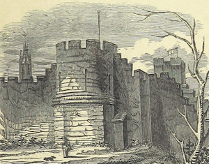
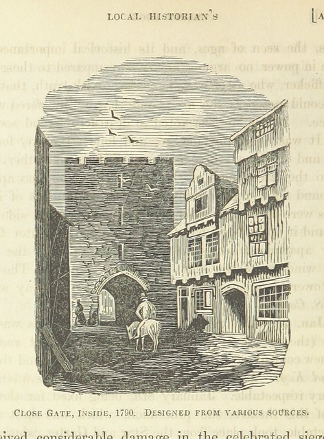
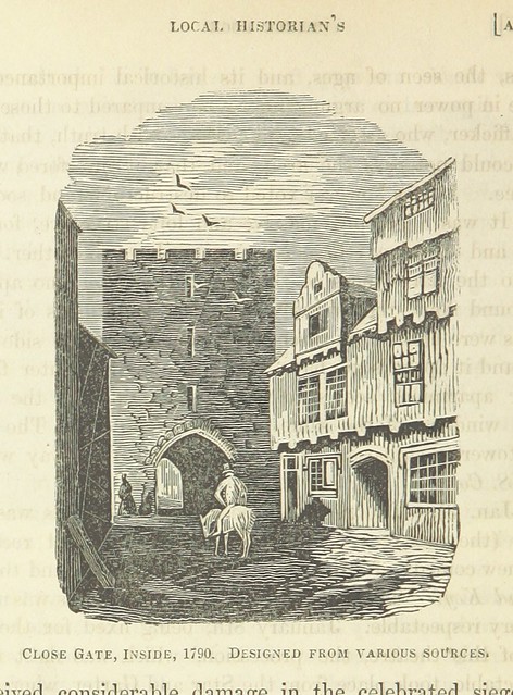 Close Gate (aka Closegate) on the Town Walls was one of the principal points of entry to Newcastle during Medieval times. In the 18th century the tower served as a a temporary prison, until the upper courses of the gateway were dismantled in 1797. This retrospective 19th century engraving depicts it as a three storey rectangular building containing a central archway.
The levelled and buried remains of Close Gate are located on the flat land at the bottom of the slope beneath The Close. The foundations and buried remains of the gate are part of a Scheduled Monument, which also includes an upstanding section of the Town Wall, near Hanover Street, and the site of Water Tower.
The Close Gate evidently derived its name from the street called the Close. After the fall of the Tyne Bridge in 1771, its tower was converted into a temporary prison. In 1797, it was taken down; the gateway being narrow, awkward, and dangerous. There was a turret, or tower, 52 yards to the south of this gate, and adjoining to the river. It was once the meeting-house of the House Carpenters' Company, and afterwards of the Sailmakers. From the Close Gate, there were an hundred and forty steps, on the top of the wall, as it mounts a very steep hill to White Friar Tower.
Extract from Eneas Mackenzie, Historical Account of Newcastle-Upon-Tyne Including the Borough of Gateshead. Mackenzie and Dent, Newcastle-upon-Tyne, 1827.
Scheduled Monument area - based on Historic England data (Open Government Licence).
from Newcastle libraries (flickr)
038469:Close Gate Newcastle upon Tyne Holmes S. 1882
Pinned by Simon Cotterill

from http://www.twsitelines.info/s…
Tyne and Wear HER(1511): Newcastle town wall, Close Gate
- "Close Gate, across the Close, was built in the mid 14th century. The only view of it (and that unreliable) shows a 3 storey tower pierced by a single central …
Added by
Simon Cotterill
from Flickr (flickr)
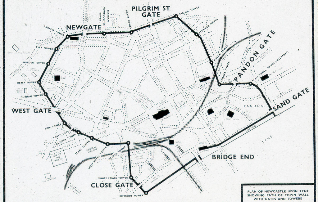
Plan of Newcstle upon Tyne showing path of Town Wall with gates and towers
Pinned by Simon Cotterill

from https://historicengland.org.u…
Newcastle upon Tyne town defences: section of curtain wall including Closegate and Water Tower - Scheduling
- ....Despite some parts of this section surviving below the level of the ground as buried features, the remains of the medieval curtain wall between Hanover Street and the River Tyne …
Added by
Simon Cotterill

from https://www.geograph.org.uk/p…
Fragment of the Newcastle Town Wall
- 14th century fragment of the Town Wall near Hanover Street. Photo by Oliver Dixon, 16 August, 2017 , Geograph, CC-BY-SA 2.0
Added by
Simon Cotterill

from Newcastle libraries (flickr)
038469:Close Gate Newcastle upon Tyne Holmes S. 1882
Pinned by Simon Cotterill
from http://www.twsitelines.info/s…
Tyne and Wear HER(1511): Newcastle town wall, Close Gate
- "Close Gate, across the Close, was built in the mid 14th century. The only view of it (and that unreliable) shows a 3 storey tower pierced by a single central …
Added by
Simon Cotterill
from Flickr (flickr)
Plan of Newcstle upon Tyne showing path of Town Wall with gates and towers
Pinned by Simon Cotterill
from https://historicengland.org.u…
Newcastle upon Tyne town defences: section of curtain wall including Closegate and Water Tower - Scheduling
- ....Despite some parts of this section surviving below the level of the ground as buried features, the remains of the medieval curtain wall between Hanover Street and the River Tyne …
Added by
Simon Cotterill
from https://www.geograph.org.uk/p…
Fragment of the Newcastle Town Wall
- 14th century fragment of the Town Wall near Hanover Street. Photo by Oliver Dixon, 16 August, 2017 , Geograph, CC-BY-SA 2.0
Added by
Simon Cotterill