Topics > Northumberland > Burdhopecrag
Burdhopecrag
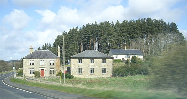
Burdhopecrag is a farm located by the A68, about 1 mile north-west of the village of Rochester. It is situated by the junction of the A68 and a private MOD road associated with the Otterburn Training Area, and the site of the Redesdale Camp. The farm was part of the Birdhopecraig estate. Historically, the place name has varied: Birdhope Craig, Birdhopecraig, Birdhopecrag (the latter shown on modern OS maps). The present farm building dates from the mid-19th century, however, a farm here was firsr recorded here in a survey of 1604.[1] The 1860 Northumberland Farm index lists Birdhopecrag Hall under Rochester township in the ancient parish of Elsdon. Today, Burdhopecrag is part of Rochester with Byrness Civil Parish. The farm is located to the north of the River Rede; nearly, south of the river is Burdhope (aka Birdhope) farm.


from Geograph (geograph)
Old Milestone by the A68, Burdehopecrag, Rochester parish
Pinned by Simon Cotterill

from https://keystothepast.info/se…
Burdhopecrag Farm (Rochester and Byrness)
- The present farm is mid-19th century in date and comprises a farmhouse and a group of farm buildings. However, the earliest reference to a farm here occurs in the early …
Added by
Simon Cotterill

from Geograph (geograph)
Old Milestone by the A68, Burdehopecrag, Rochester parish
Pinned by Simon Cotterill
from https://keystothepast.info/se…
Burdhopecrag Farm (Rochester and Byrness)
- The present farm is mid-19th century in date and comprises a farmhouse and a group of farm buildings. However, the earliest reference to a farm here occurs in the early …
Added by
Simon Cotterill