Topics > Civil Parishes in Cumbria > Bowness Civil Parish > Bowness Parish, 1848
Bowness Parish, 1848
BOWNESS (St. Michael), a parish, in the union of Wigton, Cumberland ward, and E. division of the county of Cumberland; comprising the townships of Anthorn, Bowness, Drumburgh, and Fingland; and containing 1,488 inhabitants, of whom 624 are in the township of Bowness, 14 miles (W.N.W.) from Carlisle. The parish comprises by measurement 9294 acres, of which 4953 are arable, 1088 meadow, 3152 common, moss land, or peat, and 42 wood. The village stands on a rocky promontory, commanding a fine view of the Solway Firth, on the coast of which it is situated; and occupies the site of the Roman station Tunnocellum, where, according to the Notitia, a marine cohort (cohors prima Ælia Classica) was placed. At the distance of about a mile was the western extremity of the Picts' wall, vestiges of which are conspicuous in various parts of the parish, as well as vestiges of Gabrosentum, another Roman station. Coins and other relics of the Romans, among which was an image of the god Terminus, have been discovered; and from the foundations of houses and streets, which cultivation has exposed to view, this place has evidently been of greater extent than it is at present. The ship-canal from Carlisle terminates near the village. The living is a rectory, valued in the king's books at £21. 13. 11½.; net income, £393; patron, the Earl of Lonsdale: there are 57 acres of good glebe, and 272 acres of common land, the latter only partly cultivated, and very inferior.
Extract from: A Topographical Dictionary of England comprising the several counties, cities, boroughs, corporate and market towns, parishes, and townships..... 7th Edition, by Samuel Lewis, London, 1848.
Co-Curate Page
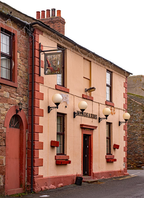
Bowness-on-Solway
- Overview About Bowness-on-Solway Map Street View Bowness-on-Solway is a village of fewer than 100 houses on the Solway Firth separating England and Scotland. The civil parish had a population …
Co-Curate Page
Anthorn
- Overview Map Street View ANTHORN, a township, in the parish of Bowness, union of Wigton, Cumberland ward, and E. division of Cumberland, 8 miles (N.W. by N.) from Wigton; containing …

from https://www.cumbriacountyhist…
Bowness on Solway Parish
- "Ancient parish in Cumberland ward, Cumberland, containing townships of Anthorn, Bowness (including village of Port Carlisle), Drumburgh (with hamlets of Easton and Glasson) and Fingland (including Whitrigg).....manor of Bowness held …
Added by
Simon Cotterill
Co-Curate Page
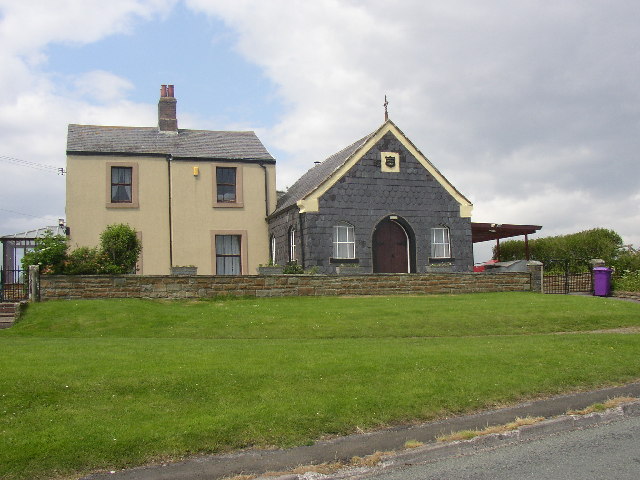
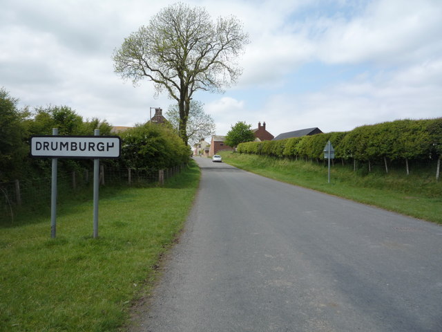
Drumburgh
- Overview About Drumburgh Map Street View Drumburgh is a village by the Solway Foss in Cumbria, located about 3 miles south-east of Bowness-on-Solway and 8 miles north-west of Carlisle. DRUMBURGH, …
Co-Curate Page
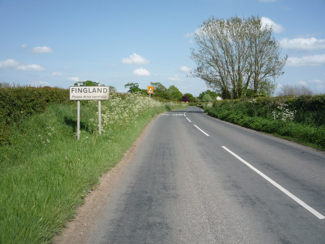
Fingland
- Overview About Fingland Map Street View FINGLAND, a township, in the parish of Bowness, union of Wigton, Cumberland ward, E. division of the county of Cumberland, 6½ miles (N.) from …

Co-Curate Page
Bowness-on-Solway
- Overview About Bowness-on-Solway Map Street View Bowness-on-Solway is a village of fewer than 100 houses on the Solway Firth separating England and Scotland. The civil parish had a population …
Co-Curate Page
Anthorn
- Overview Map Street View ANTHORN, a township, in the parish of Bowness, union of Wigton, Cumberland ward, and E. division of Cumberland, 8 miles (N.W. by N.) from Wigton; containing …
from https://www.cumbriacountyhist…
Bowness on Solway Parish
- "Ancient parish in Cumberland ward, Cumberland, containing townships of Anthorn, Bowness (including village of Port Carlisle), Drumburgh (with hamlets of Easton and Glasson) and Fingland (including Whitrigg).....manor of Bowness held …
Added by
Simon Cotterill
Co-Curate Page
Drumburgh
- Overview About Drumburgh Map Street View Drumburgh is a village by the Solway Foss in Cumbria, located about 3 miles south-east of Bowness-on-Solway and 8 miles north-west of Carlisle. DRUMBURGH, …


