Topics > Northumberland > Civil Parishes in Northumberland > Alnwick Town Council area > Alnwick Parish, 1855
Alnwick Parish, 1855
Extract from: History, Topography, and Directory of Northumberland...Whellan, William, & Co, 1855.
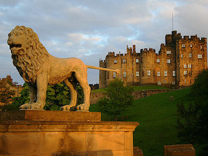
ALNWICK PARISH
ALNWICK parish is situated partly in the eastern division of Coquetdale Ward, and partly in the southern division of Bambrough Ward, It is bounded on the north and west by the parishes of Eglingham and Edlingham, to the south and east by Lesbury and Shilbottle parishes, and compries the townships of Alnwick, Alnwick South Side, Abbey Lands, Canongate, Denwick, and Hulne Park, whose united area is 16,250 acres. The population in 1801, was 4,719; in 1811 5,426; in 1821, 5,926; in 1831, 6,788; in 1841, 6,626 ; and in 1851, 7,319 souls. The soil varies very much, a great part of it being moorland, a considerable portion, however, consists of highly ornamented pleasure grounds. The mineral productions of the parish are coal, freestone, limestone, whinstone, and marble.