Topics > Civil Parishes in Cumbria > Walton Civil Parish > Walton Parish (Cumberland), 1848
Walton Parish (Cumberland), 1848
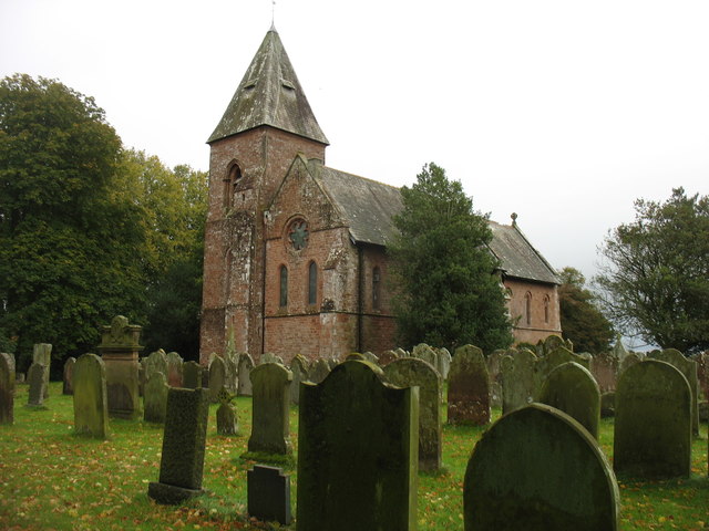
WALTON, a parish, in the union of Brampton, Eskdale ward, E. division of Cumberland; containing 440 inhabitants, of whom 152 are in High Walton, 10½ miles, and 288 in Low Walton, 10 miles, (N.E. by E.) from Carlisle. The parish comprises 3,592 acres, of which 500 are undivided moor and peat moss; the soil is generally argillaceous, interspersed with patches of fine loam. The surface is gently undulated, and the lower lands are watered by two small rivulets, called the Cambeck and Kingwater, which flow into the Irthing. The living is a perpetual curacy; net income, £131; patron, Joseph Dacre, Esq.; impropriator, W.P. Johnson, Esq. The church was rebuilt in 1813. The great tithes have been commuted for £176, and the small for £31. 7. The old Roman wall crossed the parish, which contained the station Petriana, whose site is now called Castle Steads: numerous inscriptions and other relics of antiquity have been discovered.
Extract from: A Topographical Dictionary of England comprising the several counties, cities, boroughs, corporate and market towns, parishes, and townships..... 7th Edition, by Samuel Lewis, London, 1848.