Topics > Heritage Sites > Hadrian's Wall > Wall Mile 38
Wall Mile 38
Hadrian's Wall - Wall Mile 38
Hadrian's Wall stretches from the east to west coast of England and was an important frontier of the Roman Empire. Building of the wall began in AD 122 and took six years to complete it’s 84 mile (80 Roman mile) length. Soldiers were garrisoned along the line of the wall in large forts, smaller milecastles, and intervening turrets. The Vallum, a large ditch with mounds on either side, ran along the south side of the wall, protecting the rear of the frontier. Hadrian's Wall was designated as a World Heritage Site in 1987.
Wall Mile 38:
There are significant remaining sections of Hadrian's Wall in Wall Mile 38. Milecastle 38, located near Hotbank Farm, was the site of a joint inscription of Emperor Hadrian and Governor Aulus Platorius Nepos, confirming Hadrian's role in building the Wall. The milecastle had a Type I gateway, a causeway, and was situated strategically overlooking Milking Gap.
- Milecastle 38 (Hotbank) - site near Hotbank Farm, few visible remains
- Turret 38A (Milking Gap) - no visible surace remains
- Turret 38B (Highshield Crag) - only visible as an earthwork platform
Roman sites nearby:
- Vindolanda fort - about 1 mile south of Hadrian's Wall. Vindolanda Museum (Chesterholm).
Scheduled Monument (#1010966): Hadrian's Wall and associated features between the field boundary west of turret 37a and the road to Steel Rigg car park in wall miles 37, 38 and 39
Click the headings below to expand (selected extracts from the Historic England scheduling)
%
Hadrian's Wall follows the crest of the Whin Sill throughout this section, which includes the steep rock outcrops of Hotbank Crags, Highshield Crags and Peel Crags. There are extensive views to north and south all along this section.....Hadrian's Wall survives well as an exposed and consolidated wall for the larger part this section averaging 2m wide and 1.4m high.
The wall ditch was only constructed in the gaps between the crags, as the steep craggy scarps render a ditch superfluous here. Where it was constructed the ditch survives as a visible feature. At Milking Gap the ditch averages 10m wide and 1m deep.
The glacis is better preserved at Milking Gap where it averages 6m wide.
Milecastle 38 is situated on a west facing slope with views to the north and south. It is visible as a series of turf-covered mounds and it measures 18m north east to south west by 17.4m across. The turf-covered remains of the north east wall are 2.6m wide and 1.2m high. On the south and east sides robber trenches mark where the walls were located. These measure 3.6m wide and up to 1.4m deep. There are traces of a rectangular building in the south west corner. The milecastle was partly excavated during 1935 by Simpson. Pottery found indicated occupation continued into the fourth century AD.
Turret 38a is located on the west side of Milking Gap on an east facing slope. It commands extensive views to the south and directly overlooks Crag Lough to the north. It survives as a buried feature below the turf. It was located in 1911 by Simpson.
Turret 38b is located on Highshield Crags and also has extensive views in all directions. It survives as a turf-covered platform. The platform measures 6.8m north to south and 13.4m across. There is an internal scarp up to 0.3m high. This turret was also located by Simpson in 1911.
The course of the Roman road known as the Military Way, which ran along the corridor between the Wall and the vallum linking turrets, milecastles and forts, survives well as a linear causeway throughout this section. Some stone is visible on the south scarp where it has been built up to make a level surface. This scarp appears to have had a stone revetment. The south scarp averages 0.4m in height, although it reaches up to 1.2m high in places. West of Peel Farm the Military Way is overlain by the road to Steel Rigg car park.
Scheduled Monument (#1010972): The vallum and a British settlement between the field boundary west of turret 37a and the road to Steel Rigg car park, in wall miles 37, 38 and 39
Click the headings below to expand (selected extracts from the Historic England scheduling)
%
The vallum survives well as an upstanding earthwork throughout most of this section. Where extant the north mound averages 1.7m high, the south mound 1m high and the ditch 1.2m deep. Between High Shield and Twice Brewed the B6318 road overlies parts of the vallum. However, where it runs along the line of the vallum the road lies on the south berm, which has resulted in some disturbance to the monument. To the south of Hotbank Crags the remains of the vallum have been reduced and the ditch silted up, though its course can still be traced.
A native British settlement is situated on the west side of Milking Gap between Hadrian's Wall and the vallum. It is located in a dip on the springline at the base of the slope to the south of Hotbank Crags. It survives as a series of upstanding stone remains and buried features. The settlement itself includes a rectilinear enclosure which has been subdivided around a central stone hut which has an entrance in its east side. The enclosure walls are made with double faced boulders and average 2m wide and 0.8m high. The central hut has a diameter of 7m and has internally faced walls 1.3m wide and 0.4m high. The remains of other huts survive to the south and east of the central hut with walls less than 1m wide and 0.25m high. Excavation in 1937 by Kilbride-Jones discovered pottery which showed that the settlement was occupied during the second century AD.
Listed Building, Grade I (#1156389): Hadrian's wall; milecastles 39 and 40; turrets 38A, 38B, 39A, 39B and 40A


from https://historicengland.org.u…
Hadrians Wall Milecastles and Turrets
- Hadrian's wall; milecastles 39 and 40; turrets 38A, 38B, 39A, 39B and 40A. AD 122, reconstructed AD 205. Rubble core with dressed stone faces. Course of wall runs west from …
Added by
Simon Cotterill


Co-Curate Page
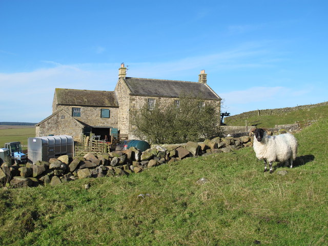
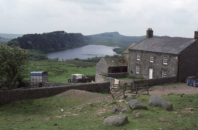
Hotbank Farm
- Overview Map Street View Hotbank is a farm in Northumberland, situated by Hotbank Crags, to the east of Crag Lough. Hotbank is on Hadrian's Wall and is close to the …
from https://historicengland.org.u…
Hadrian's Wall and associated features between the field boundary west of turret 37a and the road to Steel Rigg car park in wall miles 37, 38 and 39 - List Entry
- ...Hadrian's Wall and its associated features between the field boundary west of turret 37a and the road to Steel Rigg car park survive well as a series of buried and …
Added by
Simon Cotterill
from https://historicengland.org.u…
The vallum and a British settlement between the field boundary west of turret 37a and the road to Steel Rigg car park, in wall miles 37, 38 and 39 - List Entry
- ...The vallum and associated features, including the British settlement, between the field boundary west of turret 37a and the road to Steel Rigg car park survive well as a series …
Added by
Simon Cotterill

from https://historicengland.org.u…
Hadrians Wall Milecastles and Turrets
- Hadrian's wall; milecastles 39 and 40; turrets 38A, 38B, 39A, 39B and 40A. AD 122, reconstructed AD 205. Rubble core with dressed stone faces. Course of wall runs west from …
Added by
Simon Cotterill
Co-Curate Page
Hotbank Farm
- Overview Map Street View Hotbank is a farm in Northumberland, situated by Hotbank Crags, to the east of Crag Lough. Hotbank is on Hadrian's Wall and is close to the …
from https://historicengland.org.u…
Hadrian's Wall and associated features between the field boundary west of turret 37a and the road to Steel Rigg car park in wall miles 37, 38 and 39 - List Entry
- ...Hadrian's Wall and its associated features between the field boundary west of turret 37a and the road to Steel Rigg car park survive well as a series of buried and …
Added by
Simon Cotterill
from https://historicengland.org.u…
The vallum and a British settlement between the field boundary west of turret 37a and the road to Steel Rigg car park, in wall miles 37, 38 and 39 - List Entry
- ...The vallum and associated features, including the British settlement, between the field boundary west of turret 37a and the road to Steel Rigg car park survive well as a series …
Added by
Simon Cotterill


