Topics > Heritage Sites > Hadrian's Wall > Wall Mile 28
Wall Mile 28
Hadrian's Wall - Wall Mile 28
Hadrian's Wall stretches from the east to west coast of England and was an important frontier of the Roman Empire. Building of the wall began in AD 122 and took six years to complete it’s 84 mile (80 Roman mile) length. Soldiers were garrisoned along the line of the wall in large forts, smaller milecastles, and intervening turrets. The Vallum, a large ditch with mounds on either side, ran along the south side of the wall, protecting the rear of the frontier. Hadrian's Wall was designated as a World Heritage Site in 1987.
Wall Mile 28:
- Milecastle 28 (Walwick) - exact location unconfirmed
- Turret 28a - exact location unconfirmed
- Turret 28b - exact location unconfirmed
Scheduled Monument (#1010960): Hadrian's Wall and vallum between Chesters and the road to Simonburn in wall miles 27, 28 and 29
Click the headings below to expand (selected extracts from the Historic England scheduling)
Map showing Scheduled Monument area (Historic England data).
%
The monument includes the section of Hadrian's Wall and associated features between Chesters in the east and the minor road to Simonburn in the west. This section of the corridor occupies the steep valley side on the west bank of the North Tyne. Hadrian's Wall survives as a buried feature below grassland for most of this section. However, it is visible intermittently as an upstanding feature in two places.
Hadrian's Wall survives as a buried feature below grassland for most of this section. However, it is visible intermittently as an upstanding feature in two places. In the grounds of Chesters house a short section of Wall, 13.5m long and up to 1.1m high, is exposed. Further west near Black Carts there is a section of consolidated Wall about 140m long. The south face averages 1.2m in height and the north face 1.9m.
The wall ditch survives intermittently as a well preserved feature throughout this section. There is little trace of it above ground through the gardens of Chesters house, however it will survive as a buried feature. At Walwick, houses and gardens have been built over the line of the Wall. Beyond Walwick the ditch is visible on the ground as a depression partly overgrown by scrub and small trees. It averages about 1.7m in depth, though it reaches a maximum of 3.1m in places. The upcast mound from the ditch, known as the glacis, has been mostly ploughed out. However, it does survive well east of milecastle 29 where it reaches a height of 3.5m.
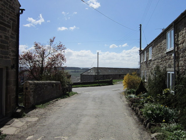
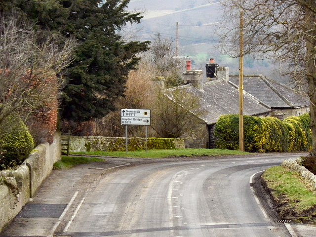
The exact location of milecastle 28 is not yet confirmed. The scarp cited as being part of the milecastle platform by the Ordnance Survey is too far south of the line of the Wall and looks to be early modern in date. The predicted location, based on the usual spacing, would be where the B6318 changes direction as it enters Walwick from the east.
the precise location of turret 28a has not yet been confirmed. However, its predicted location, on the basis of the usual spacing, is about 250m west of Archway Cottage near Walwick Hall. It is considered to survive as a buried feature below the grassland.
the precise location of turret 28b has not yet been confirmed, though it is expected to be positioned about 225m east of the road which runs north to join the B6320. This turret is also considered to survive as a buried feature below the grassland.
The course of the Roman road known as the Military Way, which ran along the corridor between the Wall and the vallum linking turrets, milecastles and forts, is not yet known with certainty. It does not survive as a feature visible on the ground. However, according to Horsley writing in 1732, the Military Way in this section followed the line of the north mound of the vallum except for where it veered towards milecastles. The present B6318 road overlies the north mound of the vallum, and therefore remains of the Military Way may survive below the modern surface.
The vallum is visible as an upstanding earthwork throughout much of this section, though in the stretch between Chesters and Towertie Plantation it has been largely ploughed out. Beyond Walwick the north mound of the vallum is overlain by the B6318 road. Here the vallum ditch averages between 1.5m and 2m in depth while the south mound averages about 2m in height except for where it has been reduced by ploughing.


from https://historicengland.org.u…
Hadrian's Wall and vallum between Chesters and the road to Simonburn in wall miles 27, 28 and 29 - List Entry
- ...Hadrian's Wall and its associated works between Chesters and the minor road to Simonburn survive intermittently as upstanding monuments and as buried features. There is one particularly well preserved section …
Added by
Simon Cotterill

")

