Topics > Heritage Sites > Hadrian's Wall > Wall Mile 12
Wall Mile 12
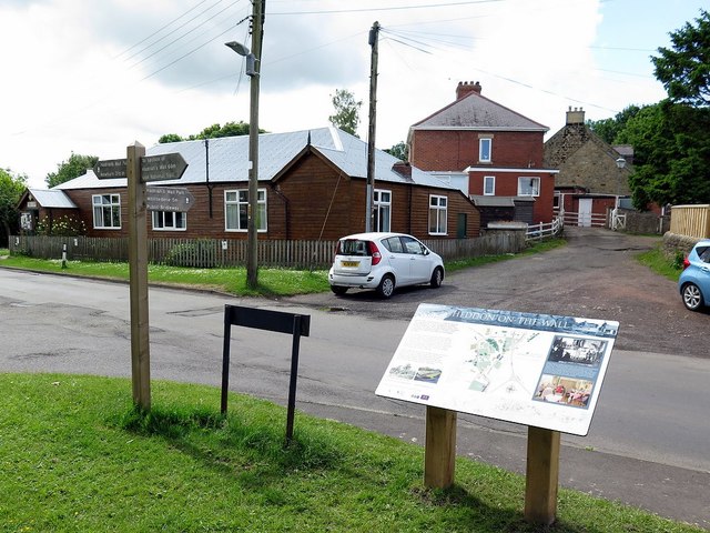
Hadrian's Wall - Wall Mile 12
Hadrian's Wall stretches from the east to west coast of England and was an important frontier of the Roman Empire. Building of the wall began in AD 122 and took six years to complete it’s 84 mile (80 Roman mile) length. Soldiers were garrisoned along the line of the wall in large forts, smaller milecastles, and intervening turrets. The Vallum, a large ditch with mounds on either side, ran along the south side of the wall, protecting the rear of the frontier. Hadrian's Wall was designated as a World Heritage Site in 1987.
Wall Mile 12:
- Milecastle 12 (Heddon)
- Turret 12a (Heddon West)
- Turret 12b (North Lodge)
Scheduled Monument (#1010617): Hadrian's Wall and vallum from East Town House, Heddon-on-the-Wall to the A69 trunk road in wall mile 12
Click the headings below to expand (selected extracts from the Historic England scheduling)
%
The monument includes a section of Hadrian's Wall, its external ditch and the vallum from Heddon-on-the-Wall in the east to the A69 trunk road in the west. This section of the Wall corridor has wide views overlooking the Tyne valley to the south and east, whereas to the north and west the ground rises gently giving a less extensive view.
The Wall survives as a buried feature for the whole of this section of its course. It lies beneath the B6318 road except at the west end of this section where it continues in a field up to the A69 trunk road.
The wall ditch survives as an earthwork for much of this section, to a maximum depth of 1.5m. The upcast counterscarp, usually known as the 'glacis', also survives up to 0.3m high in the area from north of the Three Tuns Inn to the north of North Lodge.
The exact location of milecastle 12 has not yet been confirmed. In relation to the known sites of turret 12a and turret 11b, the site of milecastle 12 is expected to lie in the vicinity of Keeper's Cottage at Heddon-on-the-Wall.
Turret 12a survives as a buried feature below the B6318 road. The location of the turret is known from part excavation by Simpson in 1930.
Turret 12b also survives as a buried feature below the B6318 road, probably extending south into the area of woodland to the west of North Lodge. As with turret 12a, part excavation by Simpson in 1930 located the site of this turret.
The course of the Roman road known as the Military Way, which ran along the corridor between the Wall and the vallum linking the turrets, milecastles and forts, has not yet been confirmed in this section of the corridor.
The vallum survives intermittently as an upstanding earthwork throughout this section. The mounds have been reduced by ploughing and the central ditch has silted up for most of its length. The south mound in this section reaches a maximum height of 1.5m, while the ditch has a maximum depth of 0.6m.


from https://historicengland.org.u…
Hadrian's Wall and vallum from East Town House, Heddon-on-the-Wall to the A69 trunk road in wall mile 12 - List Entry
- ...Hadrian's Wall and vallum and their associated features between East Town House, Heddon-on-the-Wall and the A69 survive well as a series of buried and upstanding features. Significant information on the …
Added by
Simon Cotterill

")


