Topics > Newcastle City Centre > Streets > Trafalgar Street
Trafalgar Street
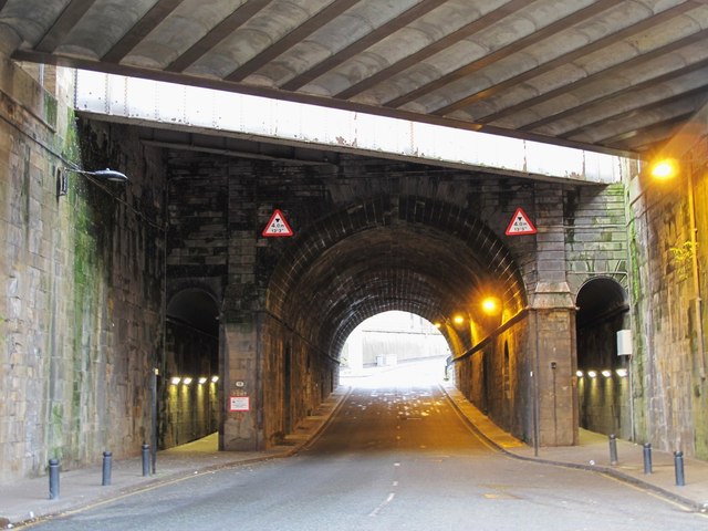
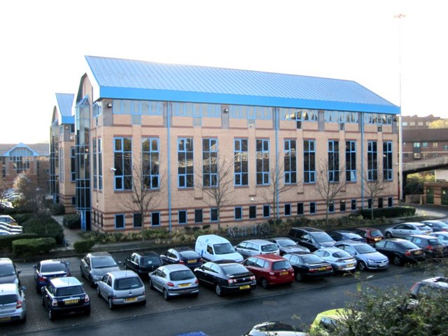
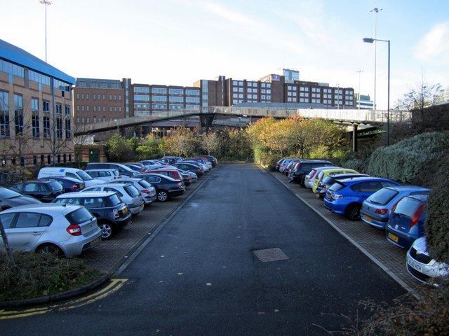
Trafalgar Street in Newcastle runs north from Melbourne Street up to Manors Metro and the Central Business & Technology Park. Trafalgar Street was significantly changed with the development of the central motorway in Newcastle; the terraced houses which used to line much of the street were demolished. The former Manors Goods Station was located nearby. Today Trafalgar Street has many office buildings such as the Technopole, Kings Manor and Eastgate House.
from Newcastle libraries (flickr)
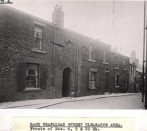
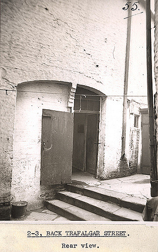
051000:Back Trafalgar Street Newcastle upon Tyne Unknown 1908
Pinned by Simon Cotterill
from Newcastle libraries (flickr)
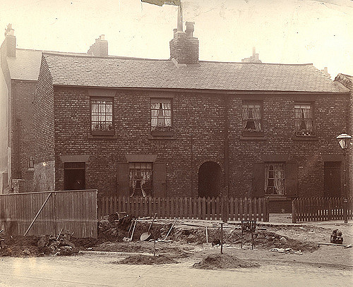
035372:Back Trafalgar Street Newcastle upon Tyne Dept of Environmental Health c.1935
Pinned by Simon Cotterill
from Newcastle libraries (flickr)
066688:Back Trafalgar Street Newcastle upon Tyne Unknown 1910
Pinned by Simon Cotterill
from Newcastle libraries (flickr)
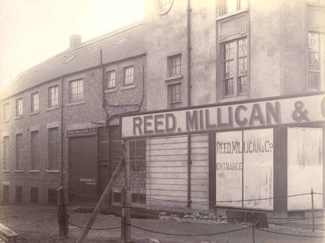
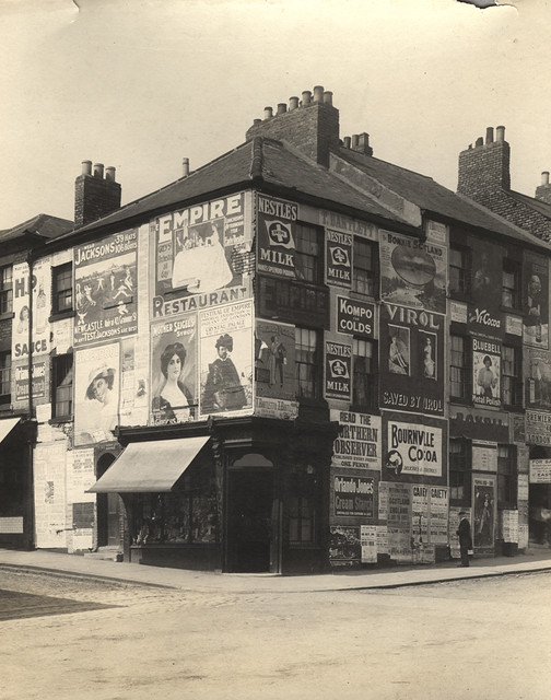
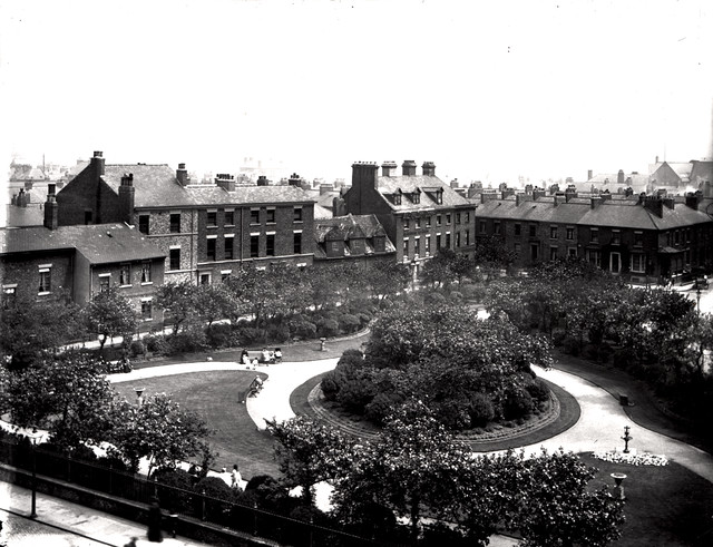
034552:Trafalgar Street Newcastle upon Tyne Dept of Environmental Health c.1935
Pinned by Simon Cotterill
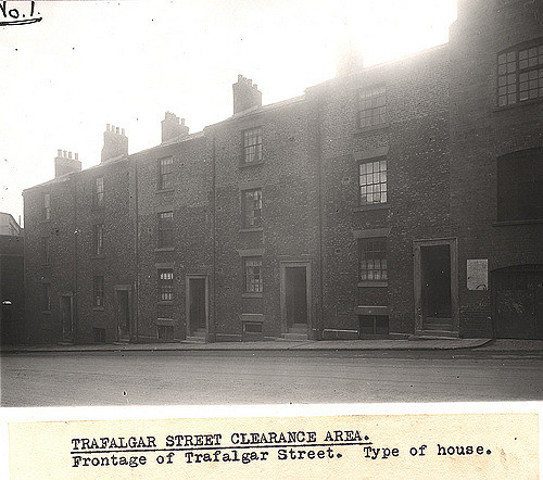
from Newcastle libraries (flickr)
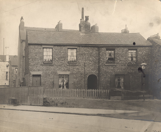
034553:Trafalgar Street Newcastle upon Tyne Dept of Environmental Health c.1935
Pinned by Simon Cotterill
from Newcastle libraries (flickr)
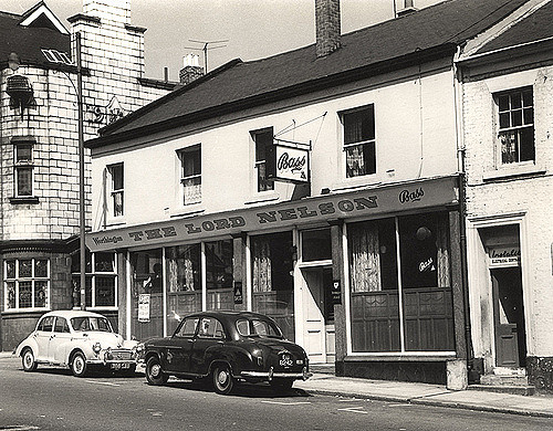
015278:The Lord Nelson Trafalgar Street 1966
Pinned by Simon Cotterill
from Newcastle libraries (flickr)
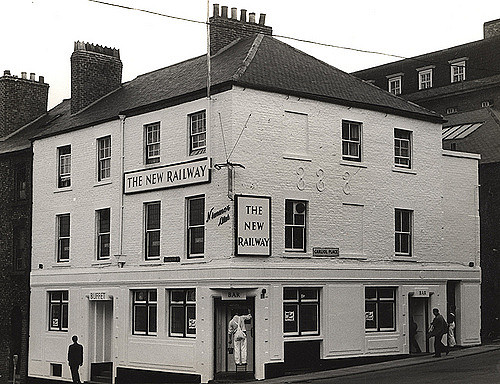
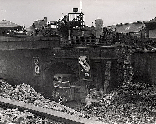
015318:The New Railway Trafalgar Street/Carliol Place 1966
Pinned by Simon Cotterill
from Newcastle libraries (flickr)
Tor149, Trafalgar Street, Newcastle upon Tyne
Pinned by Simon Cotterill
from Newcastle libraries (flickr)
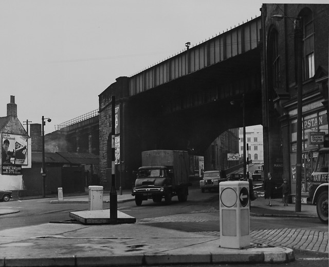
020240:Manor's Railway Station Newcastle-upon-Tyne 1971
Pinned by Simon Cotterill
from Newcastle libraries (flickr)
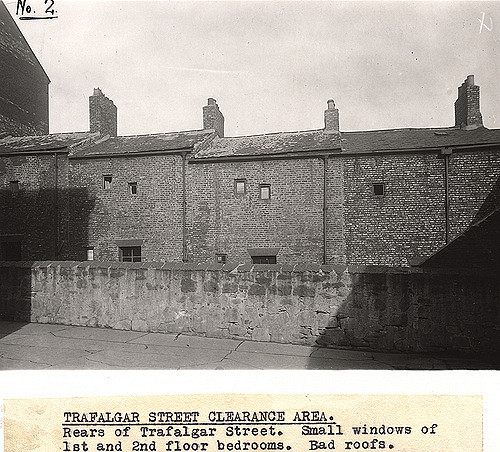
036527:Back Trafalgar Street Newcastle upon Tyne Dept of Environmental Health c.1935
Pinned by Simon Cotterill
from Newcastle libraries (flickr)
008604:Back Trafalgar Street Newcastle upon Tyne Unknown 1910
Pinned by Simon Cotterill
Co-Curate Page
Shieldfield
- Overview About Shieldfield Map Street View Shieldfield is a largely residential area, located a short distance east of Newcastle city centre. The placename derives from Anglo-Saxon meaning a shelter in …
from Geograph (geograph)
Newcastle Technopole Business Centre from New Bridge Street
Pinned by Simon Cotterill
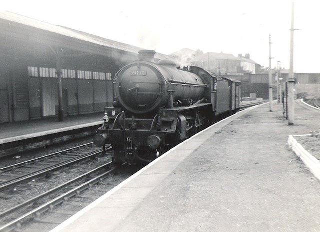
from Geograph (geograph)
B1 61237 Geoffrey H Kitson, passes light engine through Manors Station
Pinned by Simon Cotterill

from http://twsitelines.info/SMR/6…
Tyne and Wear HER(6032): Newcastle, Manors Goods Station
- "Built by 1864 after the Pandon Dene was infilled. It had been demolished by 1942 during works to clear Trafalgar Street which had been declared a slum in 1935...."
Added by
Simon Cotterill
Co-Curate Page
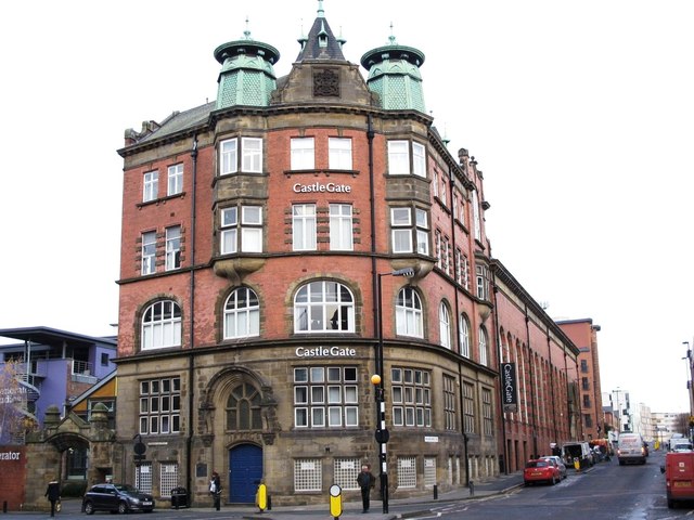
CastleGate, Newcastle
- Overview About the Building Map Street View The CastleGate Centre (closed), is located on the corner of Melbourne Street and Trafalgar Street in Newcastle. It was originally built in 1901-1903 …

from Newcastle libraries (flickr)
051000:Back Trafalgar Street Newcastle upon Tyne Unknown 1908
Pinned by Simon Cotterill
from Newcastle libraries (flickr)
035372:Back Trafalgar Street Newcastle upon Tyne Dept of Environmental Health c.1935
Pinned by Simon Cotterill
from Newcastle libraries (flickr)
066688:Back Trafalgar Street Newcastle upon Tyne Unknown 1910
Pinned by Simon Cotterill
from Newcastle libraries (flickr)
034552:Trafalgar Street Newcastle upon Tyne Dept of Environmental Health c.1935
Pinned by Simon Cotterill
from Newcastle libraries (flickr)
034553:Trafalgar Street Newcastle upon Tyne Dept of Environmental Health c.1935
Pinned by Simon Cotterill
from Newcastle libraries (flickr)
015278:The Lord Nelson Trafalgar Street 1966
Pinned by Simon Cotterill
from Newcastle libraries (flickr)
015318:The New Railway Trafalgar Street/Carliol Place 1966
Pinned by Simon Cotterill
from Newcastle libraries (flickr)
Tor149, Trafalgar Street, Newcastle upon Tyne
Pinned by Simon Cotterill
from Newcastle libraries (flickr)
020240:Manor's Railway Station Newcastle-upon-Tyne 1971
Pinned by Simon Cotterill
from Newcastle libraries (flickr)
036527:Back Trafalgar Street Newcastle upon Tyne Dept of Environmental Health c.1935
Pinned by Simon Cotterill
from Newcastle libraries (flickr)
008604:Back Trafalgar Street Newcastle upon Tyne Unknown 1910
Pinned by Simon Cotterill
Co-Curate Page
Shieldfield
- Overview About Shieldfield Map Street View Shieldfield is a largely residential area, located a short distance east of Newcastle city centre. The placename derives from Anglo-Saxon meaning a shelter in …
from Geograph (geograph)
Newcastle Technopole Business Centre from New Bridge Street
Pinned by Simon Cotterill
from Geograph (geograph)
B1 61237 Geoffrey H Kitson, passes light engine through Manors Station
Pinned by Simon Cotterill
from http://twsitelines.info/SMR/6…
Tyne and Wear HER(6032): Newcastle, Manors Goods Station
- "Built by 1864 after the Pandon Dene was infilled. It had been demolished by 1942 during works to clear Trafalgar Street which had been declared a slum in 1935...."
Added by
Simon Cotterill
Co-Curate Page
CastleGate, Newcastle
- Overview About the Building Map Street View The CastleGate Centre (closed), is located on the corner of Melbourne Street and Trafalgar Street in Newcastle. It was originally built in 1901-1903 …
Borough: Newcastle


