Topics > Cumbria > Tebay > Walney Island > Tebay Township, 1884
Tebay Township, 1884
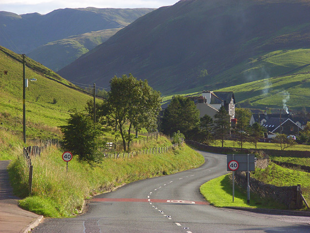
TEBAY, a township, in the parish of Orton, East ward and union, county of Westmorland, 2½ miles (S.) from Orton; containing 368 inhabitants. The township comprises 6,832 acres, of which 4,100 are common or waste. It is a mountainous district, divided into High End and Low End; and contains an ancient village, situated at the junction of the Birbeck and Lune rivulets, on the road from Kendal to Kirkby-Stephen. The Lune is crossed by the Lancaster and Carlisle railway twice near Lune Bridge, where the station has been placed for Tebay, Orton, and Kirkby-Stephen; the Birbeck stream is next crossed by a viaduct similar to that at Borrow Bridge, and here the ascent commences to Shap Fells, the highest point on the line. The vicarial tithes have been commuted for a rent-charge of £91. 12. 3; the rectorial tithes belong to the landowners. A free grammar school was endowed in 1672, by Robert Adamson, with land now producing about £40 per annum. Two large mounds in the vicinity, called Castle How, which command the pass by the river Lune, are Roman fortifications.
Extract from: A Topographical Dictionary of England comprising the several counties, cities, boroughs, corporate and market towns, parishes, and townships..... 7th Edition, by Samuel Lewis, London, 1848.