Topics > Northumberland > Civil Parishes in Northumberland > Snitter Civil Parish
Snitter Civil Parish
The Parish Council was noted as 'dormant' in 2017
Area: 9.8 km²
Population:
103 (2021 Census)
108 (2011 Census)
114 (2001 Census)
Listed buildings and scheduled monuments in Snitter Civil Parish, Northumberland, from the National Heritage List for England.
| Structure | List No. | Grade | Built~ | Note |
|---|---|---|---|---|
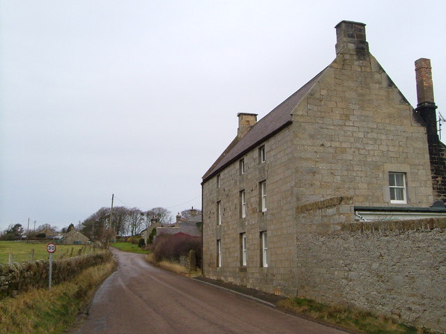
| Glebe Farmhouse | 1042061 | II | C18th | |
| Pumphouse 150 Metres West of Westfield Farmhouse | 1041914 | II | C19th | Built for for Lord Armstrong |
| The Old Schoolhouse | 1303351 | II | C16th | House. C19th alterations. |
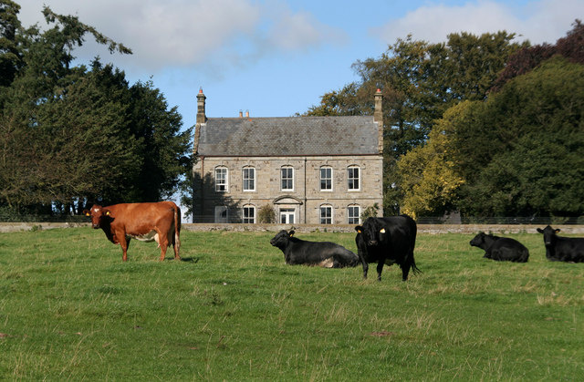
| Warton Farmhouse | 1042062 | II | C17th | Warton |
Primary source: the National Heritage List for England - NHLE is the register of nationally protected historic buildings and sites in England, including listed buildings, scheduled monuments, protected wrecks, registered parks and gardens, and battlefields. The list is maintained by Historic England. Check NHLE for updates and new entries. Secondary sources: British Listed Buildings and Keys to the Past.
Co-Curate Page
Snitter
- SNITTER, a township, in the parish and union of Rothbury, W. division of Coquetdale ward, N. division of Northumberland, 2¾ miles (N.W. by W.) from Rothbury; containing 163 inhabitants. It …
Co-Curate Page
Warton
- Overview Map Street View Warton is a hamlet in Northumberland, located about 3½ miles west of Rothbury and 16 miles north-west of Morpeth. Warton Burn flows near the settlment and …

Co-Curate Page
Snitter
- SNITTER, a township, in the parish and union of Rothbury, W. division of Coquetdale ward, N. division of Northumberland, 2¾ miles (N.W. by W.) from Rothbury; containing 163 inhabitants. It …


 effigy/tomb lid in st James church, castle eden")


