Wast Water

-
Description
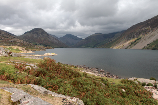
"There are several unofficial parking spots along the north west shore of Wast Water. This view was taken from the first one past cattle grid just NE of the Youth Hostel at Wasdale Hall. The shoreline here is dotted with large outcrops of rock giving good vantage points to take in the dramatic views of Yewbarrow (616m) with Kirk Fell (802m) just visible behind, Great Gable (899m) and Lingmell (900m). Just visible behind Lingmell to the right is Sca Fell leading to Scafell Pike (977m) shrouded in cloud, the highest mountain in England. The steeply rising slopes on the right of the photograph, known as the Wastwater Screes, lead up to the summits of Whin Rigg and Illgill Head. Formed as a result of ice and weathering erosion on the rocks of the Borrowdale Volcanic Group, these screes are around 2,000 feet, from top to base, the base being about 200 feet below the surface of the lake. The lake itself, is the deepest in England at 258 feet, 50 feet below sea level at it's deepest point. Wast Water is a European Designated Special Area of Conservation in respect of the specialist habitat it provides for submerged macrophyte communities typical of oligotrophic lakes. Characterized by a low accumulation of dissolved nutrient salts, supporting sparse growth of algae and other organisms, and having a high oxygen content owing to low organic content, these lakes consequently have very clear waters, with high drinking-water quality. Thus Wast Water supports a limited range of species which include the Arctic char,(Salvelinus alpinus), one of the rarest fish species in Britain and Ireland, found mainly in deep, cold, glacial lakes such as this." Photo by Kate Jewell, 2018. -
Owner
Kate Jewell -
Source
Geograph (Geograph) -
License
What does this mean? Creative Commons License
-
Further information
Link: http://www.geograph.org.uk/photo/5902303
Resource type: Image
Added by: Simon Cotterill
Last modified: 7 years, 4 months ago
Viewed: 899 times
Picture Taken: 2018-09-07 -
Co-Curate tags


