Ramsey's Lane/Common Road


-
Description
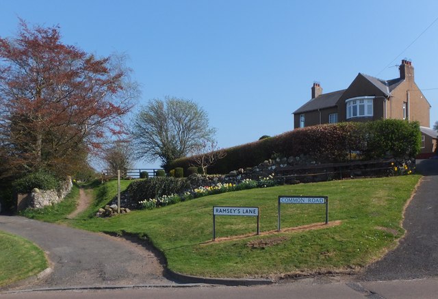
"At the southern edge of the town of Wooler, Common Road (to the right of picture) leads to tracks and paths over Wooler Common. To the left, the same road goes downhill to join Market Place and is known as Ramsey's Lane - the sign must be of some age, as it is grammatically correct: it is a good many years since address-systems introduced the regrettable practice of a blanket removal of punctuation from street- and house-names (on current street-maps this road is shown without apostrophe, viz "Ramseys Lane"). The bridleway seen heading off into the background left of picture affords wonderful views over surrounding countryside, and joins Cheviot Street just south of Wooler Youth Hostel." Photo by Barbara Carr, 2013. -
Owner
Barbara Carr -
Source
Geograph (Geograph) -
License
What does this mean? Creative Commons License
-
Further information
Link: http://www.geograph.org.uk/photo/3450935
Resource type: Image
Added by: Simon Cotterill
Last modified: 7 years, 10 months ago
Viewed: 914 times
Picture Taken: 2013-05-07 -
Co-Curate tags


