Nichol's Bog


-
Description
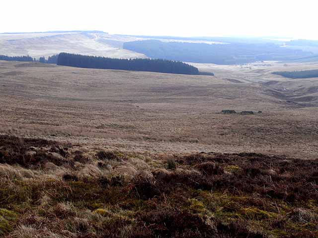
"Seen from Lough Knowe below Long Crag, looking down to Nichols' Bog and the valley of the Smallhope Burn. Part of the Emblehope estate, an extremely remote and inaccessible area in northern Northumberland, an enclave of some 3,000 hectares comprising just two houses and an extensive area of very rough wet moorland supporting some 1500 ewes, almost totally surrounded by Kielder Forest. There are a number of small scattered plantations within the area." Photo by Oliver Dixon, 2009. -
Owner
Oliver Dixon -
Source
Geograph (Geograph) -
License
What does this mean? Creative Commons License
-
Further information
Link: http://www.geograph.org.uk/photo/1185539
Resource type: Image
Added by: Simon Cotterill
Last modified: 7 years, 10 months ago
Viewed: 664 times
Picture Taken: 2009-02-28 -
Co-Curate tags


")


