Lemington Gut

-
Description
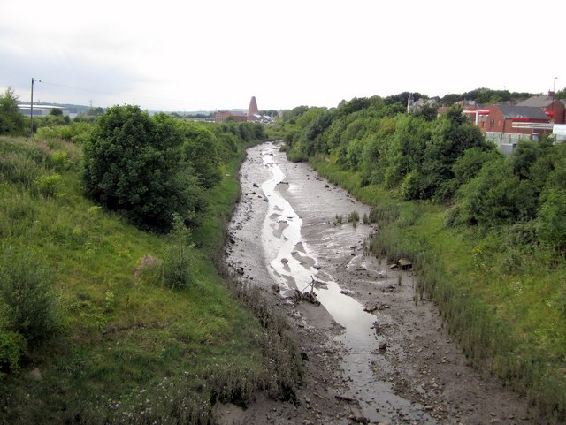
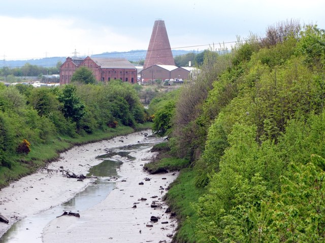
"The Gut was the previous course of the River Tyne until a meander was removed to improve navigation in c.1880. After the wooden staiths at Lemington, used to load coal from the waggon ways into barges (keels) for transport down river, fell into disuse the channel was no longer dredged, and has silted up. The river is still tidal at this point, and at low tide is mainly mud, although does carry the minor stream flow coming from Sugley Dene. The photo is taken from Lemington Bridge, built across the mouth of the Gut in 2001, providing dual carriageway road access to Newburn Riverside Business Park situated on the flat riverside land known as Newburn Haugh. http://www.bridgesonthetyne.co.uk/leming.html In the distance can be seen the cone of Lemington Glassworks [[359878]] and the former power station [[38925]] built on the site of the Tyne Iron Works." Photo by Andrew Curtis, 2010. -
Owner
Andrew Curtis -
Source
Geograph (Geograph) -
License
What does this mean? Creative Commons License
-
Further information
Link: http://www.geograph.org.uk/photo/1991980
Resource type: Image
Added by: Pat Thomson
Last modified: 8 years, 4 months ago
Viewed: 960 times
Picture Taken: 2010-08-02 -
Co-Curate tags


