Remains of Lemington Staiths, Lemington Gut

-
Description
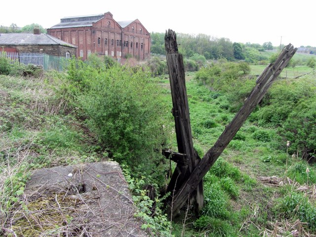
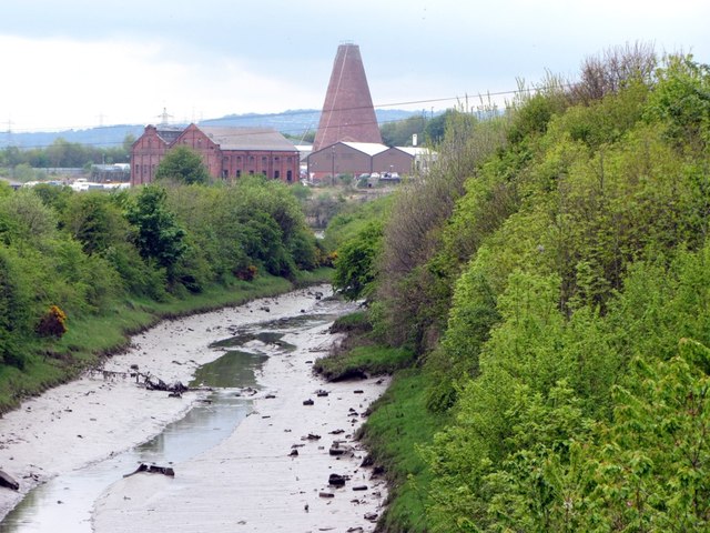
"Lemington was about the highest point upstream on the north side of the River Tyne suitable for coal staiths. Coal, transported in waggons along railed waggonways, initially horse-drawn on wooden rails, but later pulled by steam locomotives on iron rails, was loaded here onto shallow-bottomed keel boats for transport down river, where the cargo was then transferred to sea-going colliers. Staiths were recorded here by 1640, and in the C18th several waggonways terminated near this point, notably the Holywell Reins Way (1767), the Walbottle Moors Way (1781), the Wylam Waggonway (1748) and the Throckley Way (1751). The last of the staiths to remain in use, of which this structure is probably a remnant, were the Walbottle Staith of the Walbottle Coal Co. Ltd., and the Throckley Staith of the Throckley Coal Co. Ltd. Lemington coal staiths were marked as disused by 1952, superseded by transport by main line train. There is another photo here [[3466680]] River improvements by the Tyne Improvement Commissioners in the 1880s cut a new channel across a large meander, closing upstream river access to this channel (known as [[3466582]]). Dredging of the former river bed continued to provide access for boats down river near to Lemington Point [[47391]] while the staiths remained in use, but it has now largely silted up. http://sine.ncl.ac.uk/view_structure_information.asp?struct_id=345 The brick building behind is the Lemington Electric Power Station which was constructed in 1903/4 on part of the site of a former ironworks. The station ceased generating in 1919, but continued in use until 1946 as a substation, supplying power for the local tramway route to Throckley (which ceased in 1946). http://sine.ncl.ac.uk/view_structure_information.asp?struct_id=348 The low building on the left is described here [[1986758]] http://heddonhistory.weebly.com/1/post/2013/05/lemington-staiths-and-lemington-gut.html" Photo by Andrew Curtis, 2013. -
Owner
Andrew Curtis -
Source
Geograph (Geograph) -
License
What does this mean? Creative Commons License
-
Further information
Link: http://www.geograph.org.uk/photo/3466644
Resource type: Image
Added by: Pat Thomson
Last modified: 8 years, 4 months ago
Viewed: 1001 times
Picture Taken: 2013-05-19 -
Co-Curate tags


