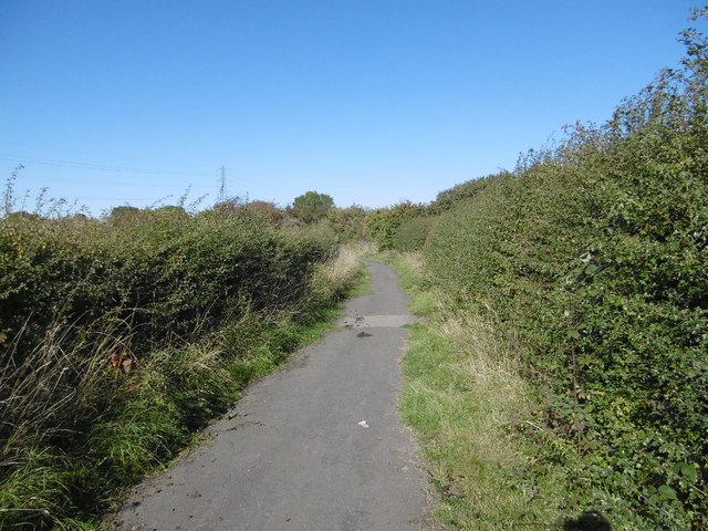
Closed road, Backworth

  • Description

    "The road is shown as a white road on the 1976 Ordnance Survey map, suggesting that it was probably no longer open to public motorised traffic then. Now it is part of the local path network and National Cycle Network." Photo by Richard Webb, 2015.
  • Owner

    Richard Webb
  • Source

    Geograph (Geograph)
  • License

    What does this mean? Creative Commons License
  • Further information

    Link: http://www.geograph.org.uk/photo/4867121
    Resource type: Image
    Added by: Simon Cotterill
    Last modified: 6 years, 3 months ago
    Viewed: 492 times
    Picture Taken: 2015-10-01
  • Co-Curate tags

Comments

Add a comment or share a memory.

Login to add a comment. Sign-up if you don't already have an account.

ABOUT US

Co-Curate is a project which brings together online collections, museums, universities, schools and community groups to make and re-make stories and images from North East England and Cumbria. Co-Curate is a trans-disciplinary project that will open up 'official' museum and 'un-officia'l co-created community-based collections and archives through innovative collaborative approaches using social media and open archives/data.

LATEST SHARED RESOURCES