Ruins of Piercebridge Roman bridge

-
Description
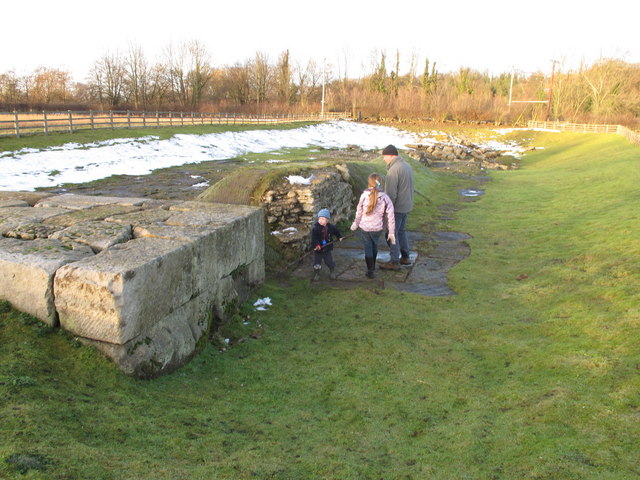
"The masonry in the foreground is the bridge abutment built in the 2nd Century AD on the south bank of the River Tees. This bridge replaced an earlier one which had been washed away in a flood, and Dere Street had to be diverted about 200 metres to cross the new bridge. The course of the Tees moved progressively further north, and the south end of the bridge was replaced by a causeway. Eventually the river moved beyond the position of this bridge; it is just beyond the line of trees. The present road bridge is about 400 metres away, by the site of the Roman fort and the present village. The ruins are in an excavated hollow. There was some snow in the hollow when we visited." Photo by David Hawgood, 2010. -
Owner
David Hawgood -
Source
Geograph (Geograph) -
License
What does this mean? Creative Commons License
-
Further information
Link: http://www.geograph.org.uk/photo/2199716
Resource type: Image
Added by: Simon Cotterill
Last modified: 8 years, 8 months ago
Viewed: 946 times
Picture Taken: 2010-12-11 -
Co-Curate tags


