High Frequency Direction Finding (HFDF) tower base, Shoreswood

-
Description
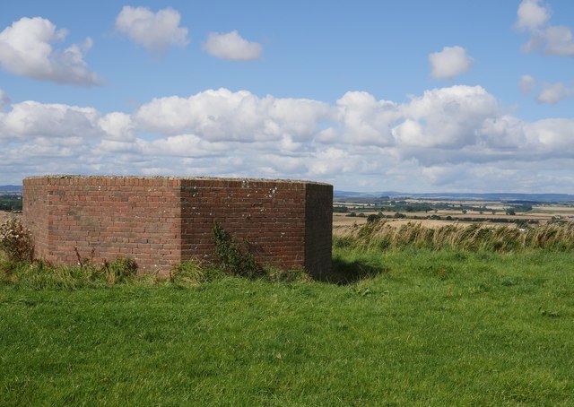
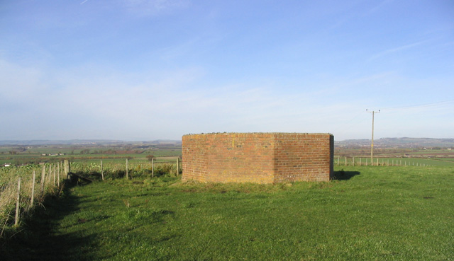
"All that remains of this WWII structure is the octagonal brick enclosure which protected a three-storey wooden tower. Together with two more HFDF towers in the area, comparison of signals received enabled the positions of aircraft to be pinpointed. RAF Winfield, Milfield and Charterhall are all within a relatively short distance of the site." Photo by James T M Towill, 2017. -
Owner
James T M Towill -
Source
Geograph (Geograph) -
License
What does this mean? Creative Commons License
-
Further information
Link: http://www.geograph.org.uk/photo/5526500
Resource type: Image
Added by: Simon Cotterill
Last modified: 8 years, 8 months ago
Viewed: 867 times
Picture Taken: 2017-09-02 -
Co-Curate tags


