The remains of a High Frequency Direction Finding Tower

-
Description
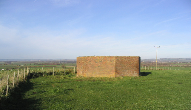
"This base on Shoreswood Ewe Hill is a reminder of the wartime role of an HFDF (High Frequency Direction Finding) station. In the 1940's the octagonal brick enclosure protected a 3 storey wooden tower, from where high frequency radio signals were exchanged with aircraft to guide them to their bases. In those days there were several training aerodromes in the area. There were at least two more HFDF towers in the area to allow aircraft positions to be cross referenced. There is a platform within the enclosure with a viewpoint indicator. (Source: Information boards on site)." Photo by Walter Baxter, 2006. -
Owner
Walter Baxter -
Source
Geograph (Geograph) -
License
What does this mean? Creative Commons License
-
Further information
Link: http://www.geograph.org.uk/photo/282248
Resource type: Image
Added by: Simon Cotterill
Last modified: 8 years, 8 months ago
Viewed: 725 times
Picture Taken: 2006-11-19 -
Co-Curate tags
")


