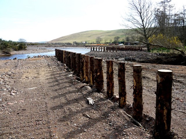
River Breamish, Ingram - flood control measures

-
Description
"The river bed has wandered around the flood plain downstream of Ingram bridge during its long history since the end of the Ice Age and has deposited large expanses of underlying gravel. Some of the old channels are clearly visible in aerial photo images now well north of the modern road. The current course of the river is a meandering, heavily braided channel characterised by large gravel bars. Periodic major flood events have probably always occurred here but now have the potential for much larger effects on the economy of the valley including damage to buildings and transport. Recent flood events (e.g. September 2008) produced many localised alterations of the channel and the current consolidation is an attempt to exert control and reduce the likelihood of downstream damage. http://www.cheviotfutures.co.uk/phpdocuments/63.pdf Interestingly, similar large-scale flooding events may have coincided with the ending of occupation of many agricultural sites in the deforested hills in this part of the Cheviots during the Roman Iron Age period and led to the accumulation of huge amounts of gravel and boulders down river at Powburn." Photo by Andrew Curtis, 2010. -
Owner
Andrew Curtis -
Source
Geograph (Geograph) -
License
What does this mean? Creative Commons License
-
Further information
Link: http://www.geograph.org.uk/photo/1796806
Resource type: Image
Added by: Simon Cotterill
Last modified: 8 years, 5 months ago
Viewed: 1409 times
Picture Taken: 2010-04-09 -
Co-Curate tags


