Minor road entering Gurney Valley


-
Description
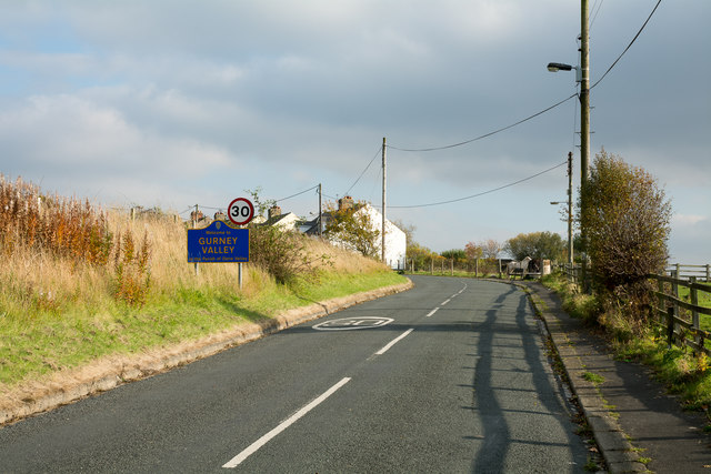
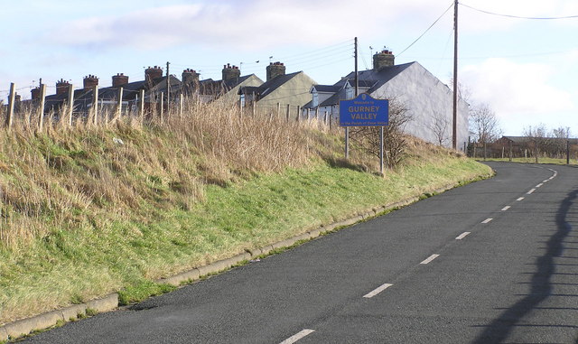
"There seems to be no valley involved in the small settlement of Gurney Valley; the word appears simply to be part of a place name and in no way descriptive. The settlement is little more than a single terrace of houses lying to the north of another small place, Coundon Grange. The blue and yellow road sign is in a style commonly found in County Durham; there's a particular proliferation of such signs in the area between Bishop Auckland and Shildon. Additional information added June 2017, received from an interested party: - There was development here of rows of houses originally called Gurney Villas, a reference to the Norfolk origins of the family of the landowner's wife. There was a number of terraces along the hillside but in the Category D village 'clean up' the settlement was renamed Gurney Vale then Valley, (for no known reason), and most of the rows were demolished." Photo by Trevor Littlewood, 2015. -
Owner
Trevor Littlewood -
Source
Geograph (Geograph) -
License
What does this mean? Creative Commons License
-
Further information
Link: http://www.geograph.org.uk/photo/4716910
Resource type: Image
Added by: Simon Cotterill
Last modified: 8 years, 11 months ago
Viewed: 1024 times
Picture Taken: 2015-10-26 -
Co-Curate tags


