Railway Terrace, Stanley Hill Top, Crook


-
Description
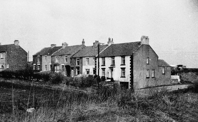
"The house at the end of this row was a former pub, called the Forresters. This village was classified as category "D" in the 1960s and damned to have no development. However, this policy was later abandoned. A railway ran up to this high point from Crook, up "the fearsome Stanley incline", no doubt pulled by cable or with special wheels like cogs. It was said that residents could hear the pitmen walking underground as they went to work. A reservoir lies to the rear of these houses." Photo by Tom Jolliffe, 1977. -
Owner
Tom Jolliffe -
Source
Geograph (Geograph) -
License
What does this mean? Creative Commons License
-
Further information
Link: http://www.geograph.org.uk/photo/360666
Resource type: Image
Added by: Simon Cotterill
Last modified: 8 years, 11 months ago
Viewed: 1161 times
Picture Taken: 1977-06-00 -
Co-Curate tags


