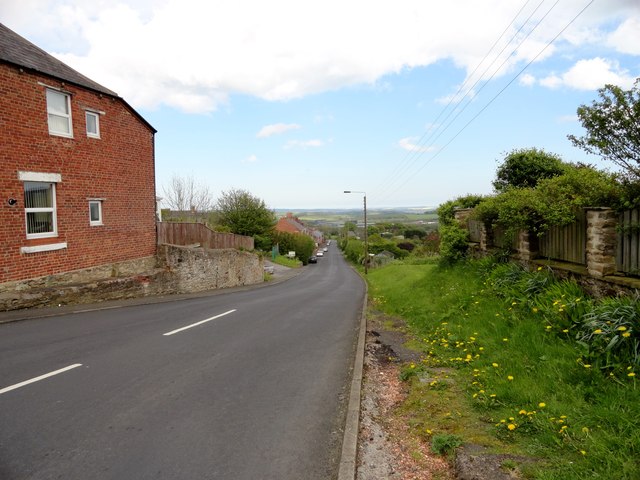
Looking down South View bank, Tantobie

  • Description

    "Tantobie village is built on a slope leading up from the Stanley road, the B6173. When I lived near here in the 1950's, this road was always called "Kitty Reed's Bank", although I never knew why." Photo by Robert Graham, 2014.
  • Owner

    Robert Graham
  • Source

    Geograph (Geograph)
  • License

    What does this mean? Creative Commons License
  • Further information

    Link: http://www.geograph.org.uk/photo/4775431
    Resource type: Image
    Added by: Simon Cotterill
    Last modified: 6 years, 9 months ago
    Viewed: 605 times
    Picture Taken: 2014-05-14
  • Co-Curate tags

Comments

Add a comment or share a memory.

Login to add a comment. Sign-up if you don't already have an account.

ABOUT US

Co-Curate is a project which brings together online collections, museums, universities, schools and community groups to make and re-make stories and images from North East England and Cumbria. Co-Curate is a trans-disciplinary project that will open up 'official' museum and 'un-officia'l co-created community-based collections and archives through innovative collaborative approaches using social media and open archives/data.

LATEST SHARED RESOURCES