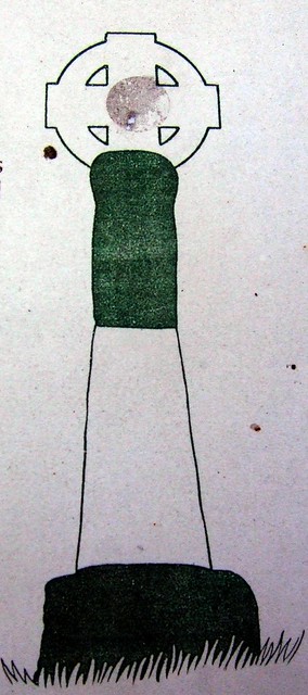
Drawing of how the Rey Cross may have looked when complete

-
Description
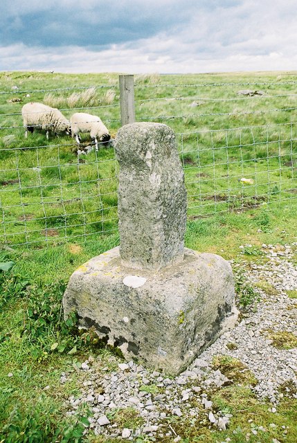
The Rey Cross, also known as Rere Cross, stands today on the north side of the A66 on Stainmore, County Durham, England. What survives is little more than a stump consisting of the socket and a fragment of the shaft. Before it was moved to its present location, it stood on a mound of rock a little further west on the south side of the road. It is believed to be an Anglo-Scandinavian cross, possibly of the tenth century. All evidence seems to point to its use as a boundary marker between Cumbria and Northumbria. The name Rey has been explained as deriving from Old Norse hreyrr, "cairn" or "boundary cairn". Local tradition says the cross was erected over the burial place of Eric Bloodaxe, last Viking Ruler of York, who was killed in an ambush by Earl Maccus, on Stainmore after having being betrayed by Count Oswulf of Bernicia in 924AD. The Flores historiarum (early 13th century) by Roger of Wendover says: "King Eric was treacherously killed by Earl Maccus in a certain lonely place which is called Stainmore, with his son Haeric and his brother Ragnald, betrayed by Earl Oswulf; and then afterwards King Eadred ruled in these districts." Archeological excavations in 1990, however, found no signs of a burial and the final resting place of Bloodaxe remains a mystery. http://en.wikipedia.org/wiki/Eric_Bloodaxe#Rey_Cross" >en.wikipedia.org/wiki/Eric_Bloodaxe#Rey_Cross -
Owner
spratmackrel -
Source
Flickr (Flickr) -
License
What does this mean? Attribution-ShareAlike License
-
Further information
Link: https://www.flickr.com/photos/30591976@N05/4055944038/
Resource type: Image
Added by: Simon Cotterill
Last modified: 8 years, 9 months ago
Viewed: 1184 times
Picture Taken: 2009-03-15T18:23:11 -
Co-Curate tags


