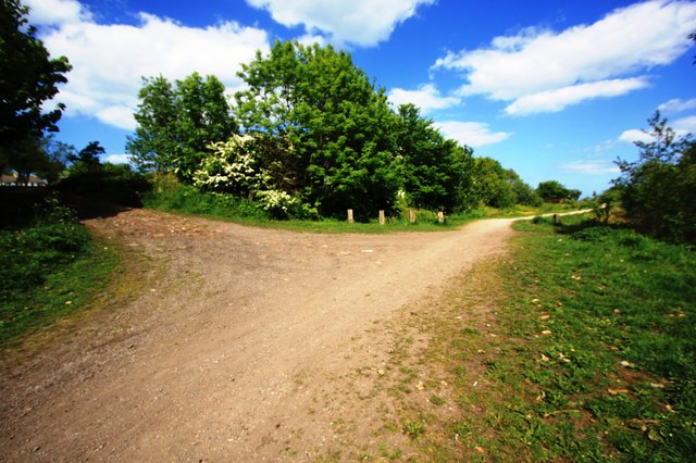
Track junction near Hesleden

-
Description
"This photograph shows a view of a track junction formed by the intersection of the Haswell to Hart Cycleway/Walkway (running from left to right) with the track/footpath from the village of Hesleden (joining from the top left). The picture was taken looking in an east-north-easterly direction towards High Hesleden." Photo by Philip Barker, 2010, and licensed for reuse under a Creative Commons Licence. -
Owner
Geograph.org.uk -
Source
Geograph (Geograph) -
License
What does this mean? Attribution-ShareAlike 2.0 Generic (CC BY-SA 2.0)
-
Further information
Link: http://www.geograph.org.uk/photo/1891870
Resource type: Text/Website
Added by: Simon Cotterill
Last modified: 9 years, 2 months ago
Viewed: 888 times
Picture Taken: Unknown -
Co-Curate tags


