Remains of Newcastle Town Wall, off Orchard Street

-
Description
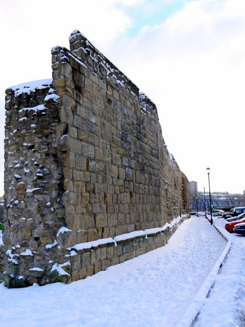
"The wall was approximately 3km (2 miles) long, at least 2m (6.5 ft) thick and up to 7.6m (25 ft) high. It was constructed during the C13th and C14th to repel Scottish invaders. Much of it was demolished as an aid to redevelopment in the C18th and C19th. The side of the wall facing here was the outside, the medieval town lying to the east. The section of wall to the north was demolished to make way for the railway. This well preserved section survived between C19th factories in an industrial area including the Hanover Square Brewery, a vinegar manufacturing works and machine shops. To the south, the wall continued to White Friar Tower, located just north of Hanover Street, and then steeply down the slope to Close Gate and the riverside at the current location of the Copthorne Hotel." Photo by Andrew Curtis, 2010, and licensed for reuse under a Creative Commons Licence. -
Owner
Geograph.org.uk -
Source
Geograph (Geograph) -
License
What does this mean? Attribution-ShareAlike 2.0 Generic (CC BY-SA 2.0)
-
Further information
Link: http://www.geograph.org.uk/photo/2169182
Resource type: Text/Website
Added by: Pat Thomson
Last modified: 10 years, 6 months ago
Viewed: 1406 times
Picture Taken: Unknown -
Co-Curate tags
")


