Town Walls (by Bath Lane, NE1)


-
Description
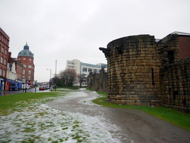
"Photo shows the stretch of late 13th C Town Wall between Westgate Road and NZ2464 : The Heber Tower. The original wall was 20ft high, and it is not far short of its full height here. Just to the right of centre is Durham Tower, one of the least altered and best preserved. There is a continuous lane inside the walls. This part of the wall is Grade I." Photo by Mike Quinn, 2010, and licensed for reuse under a Creative Commons Licence. -
Owner
Geograph.org.uk -
Source
Geograph (Geograph) -
License
What does this mean? Attribution-ShareAlike 2.0 Generic (CC BY-SA 2.0)
-
Further information
Link: http://www.geograph.org.uk/photo/4496650
Resource type: Text/Website
Added by: Pat Thomson
Last modified: 10 years, 6 months ago
Viewed: 1019 times
Picture Taken: Unknown -
Co-Curate tags


