Rookhope Village


-
Description
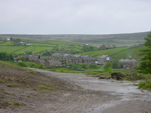
"Situated around the Boltsburn Mine - a very rich lead mine in its day. The foreground in part of the massive tailings heaps (crushed waste rock from the mineral dressing plant). This village, although situated in the valley bottom is over 1000 feet above sea level." Photo by Malcolm Street, 2002, and licensed for reuse under a Creative Commons Licence. -
Owner
Geograph.org.uk -
Source
Geograph (Geograph) -
License
What does this mean? Attribution-ShareAlike 2.0 Generic (CC BY-SA 2.0)
-
Further information
Link: http://www.geograph.org.uk/photo/53131
Resource type: Text/Website
Added by: Simon Cotterill
Last modified: 10 years, 8 months ago
Viewed: 1210 times
Picture Taken: Unknown -
Co-Curate tags


