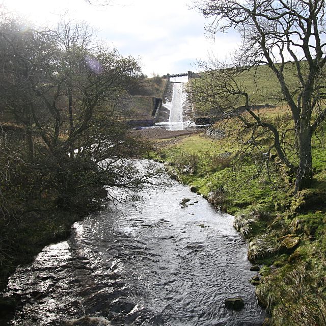
The start of the Balder descent

-
Description
"The River Balder has not been free-flowing since the Hury reservoir was built in 1892, so any navigation by boat must now start here.The pool below the overspill channel is readily accessible through a gate to the right of this photograph, though there is no convenient parking nearer than either end of the dam. The south end car park is very open to scrutiny by water company staff which may be an issue for some paddlers depending on intentions. The River needs a lot more water in it than this to be paddled, and trees can be a significant hazard. Most of the flow is coming from the tailrace somewhat hidden behind the grassy bank to the right of the picture, with only a small amount coming down the spillway. The spillway itself has seen descents by canoeists, but the authorities do not really approve. If there is enough water to paddle the river, the spillway is likely to be very fast with a significant impact and stopper at the bottom - canoe descents seem to have mostly been done in a low level such as seen here, at which level the river will not really 'go'." Photo by Andy Waddington, 2009, and licensed for reuse under a Creative Commons Licence. -
Owner
Geograph.org.uk -
Source
Geograph (Geograph) -
License
What does this mean? Attribution-ShareAlike 2.0 Generic (CC BY-SA 2.0)
-
Further information
Link: http://www.geograph.org.uk/photo/1577858
Resource type: Text/Website
Added by: Pat Thomson
Last modified: 10 years, 4 months ago
Viewed: 1018 times
Picture Taken: Unknown -
Co-Curate tags


