Wall Mile 7

  • Description

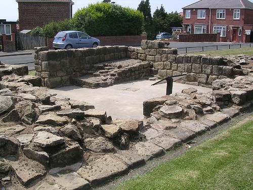
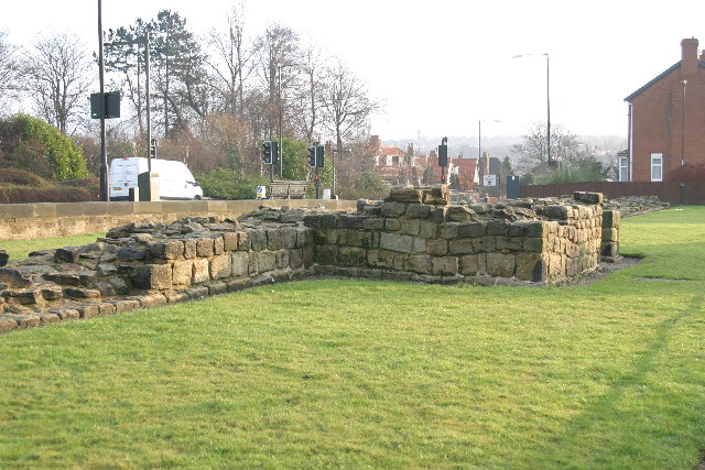
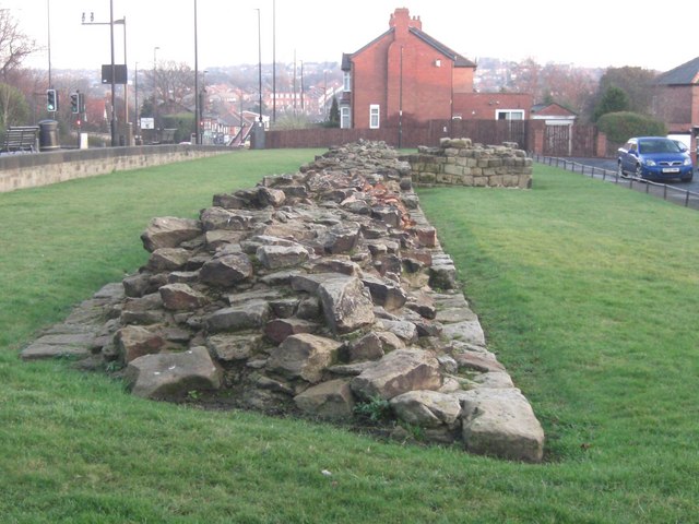
    Turret 7b (Denton Hall). According to the 1972 Ordnance Survey Hadrian's Wall map, this was the first part of Hadrian's Wall to be taken into guardianship by the Ministry of Works on 4.6.34. Looking SW. Handbook pp.160–1.
  • Owner

    The Armatura Press
  • Source

    Flickr (Flickr)
  • License

    What does this mean? Attribution-NonCommercial-ShareAlike License
  • Further information

    Link: https://www.flickr.com/photos/83154955@N00/177774379/
    Resource type: Image
    Added by: Simon Cotterill
    Last modified: 7 years, 2 months ago
    Viewed: 771 times
    Picture Taken: Unknown
  • Co-Curate tags

Comments

Add a comment or share a memory.

Login to add a comment. Sign-up if you don't already have an account.

ABOUT US

Co-Curate is a project which brings together online collections, museums, universities, schools and community groups to make and re-make stories and images from North East England and Cumbria. Co-Curate is a trans-disciplinary project that will open up 'official' museum and 'un-officia'l co-created community-based collections and archives through innovative collaborative approaches using social media and open archives/data.

LATEST SHARED RESOURCES