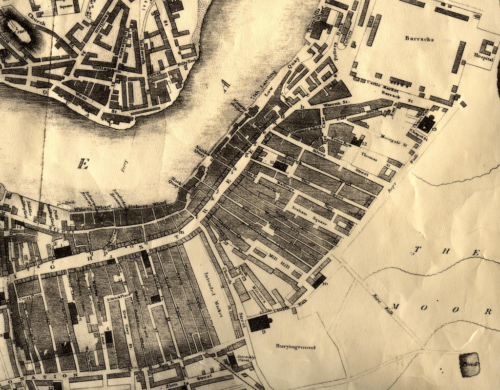
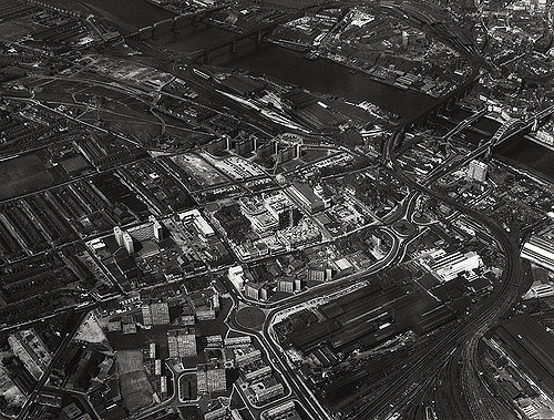
Gateshead, OS 1919


-
Description
Section from Ordnance Survey map of Gateshead (and the Newcastle Upon Tyne Quayside), 1919. Crown copyright in this map expired in 1970 and now has unrestricted Creative Commons status - available for reuse by any person, in any way (including re-editing), in any context and without restrictions of any kind. [For highest resolution reassemble the two half-length images also available in this Photostream]. -
Owner
Victoria Sage -
Source
Victoria Sage (Flickr) -
License
What does this mean? Attribution License
-
Further information
Link: https://www.flickr.com/photos/74726036@N04/7346358092/
Resource type: Image
Last modified: 11 years, 6 months ago
Viewed: 2041 times
Picture Taken: Unknown -
Co-Curate tags


