Corporation Road

-
Description
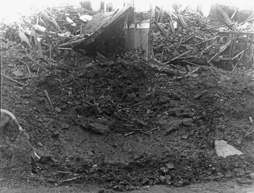
11th October 1942, Corporation Road. One 500kg High Explosive bomb landed in the centre of the roadway leaving a crater 36' by 12' deep. The bomb demolished part of a school and five houses, 20 houses were seriously damaged and a large area of residential property affected. Seven people were killed and 21 seriously injured (including a special constable proceeding to duty) 54 people were slightly injured. Gas, electricity and water supplies were affected.3 To see a map of the bombs that fell and read the stories of the poeple of Sunderland please visit <a href="http://tinyurl.com/sunderlandtpyf" -
Owner
Sunderland Public Libraries -
Source
Sunderland Public Libraries (Flickr) -
License
What does this mean? Attribution-NonCommercial-ShareAlike License
-
Further information
Link: https://www.flickr.com/photos/33844814@N06/3150054025/
Resource type: Image
Last modified: 11 years, 5 months ago
Viewed: 1188 times
Picture Taken: Unknown -
Co-Curate tags


