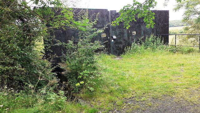
Blocked SE end of Viaduct Bridge

  • Description

    "Ordnance Survey records indicate that a benchmark levelled at 19.455m above Newlyn Datum was verified in 1954 on top of the SW bridge parapet (near the left hand side of the image)" Photo by Roger Templeman, 2021.
  • Owner

    Roger Templeman
  • Source

    Geograph (Geograph)
  • License

    What does this mean? Creative Commons License
  • Further information

    Link: http://www.geograph.org.uk/photo/6897797
    Resource type: Image
    Added by: Simon Cotterill
    Last modified: 20 hours, 31 minutes ago
    Viewed: 10 times
    Picture Taken: 2021-07-12
  • Co-Curate tags

Comments

Add a comment or share a memory.

Login to add a comment. Sign-up if you don't already have an account.

ABOUT US

Co-Curate is a project which brings together online collections, museums, universities, schools and community groups to make and re-make stories and images from North East England and Cumbria. Co-Curate is a trans-disciplinary project that will open up 'official' museum and 'un-officia'l co-created community-based collections and archives through innovative collaborative approaches using social media and open archives/data.

LATEST SHARED RESOURCES