Site of former Crindledykes Waggonway


-
Description
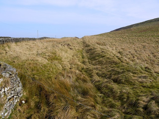
"The waggonway was used to transport coal, lead and lime around the area. It was part of a series of waggonways that served sites like West Crindledikes limekiln. http://www.keystothepast.info/article/10339/Site-Details?PRN=N20368 The route here is just parallel to the Roman Stanegate. In the other direction it crosses the line of Stanegate at a shallow angle and turns away to the north to join the main waggonway near Bradleyhall Wood. This ran along the east side of Chainley Burn down to Bardon Mill [[162064]] http://sites.google.com/site/waggonways/ny/75/ny7565" Photo by Andrew Curtis, 2012. -
Owner
Andrew Curtis -
Source
Geograph (Geograph) -
License
What does this mean? Creative Commons License
-
Further information
Link: http://www.geograph.org.uk/photo/2865562
Resource type: Image
Added by: Simon Cotterill
Last modified: 2 months, 4 weeks ago
Viewed: 54 times
Picture Taken: 2012-03-24 -
Co-Curate tags


