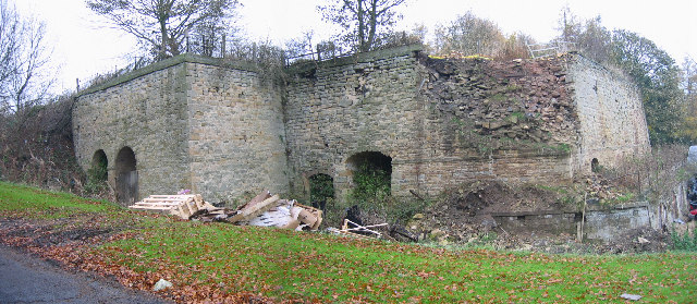
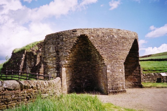
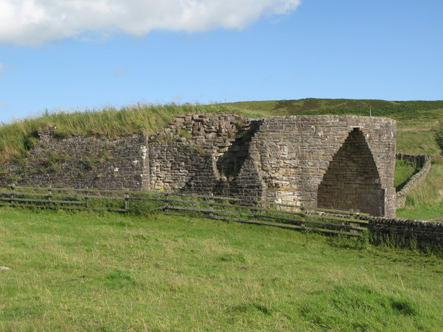
Topics > Northumberland > Bardon Mill > Crinkledikes Lime Kiln
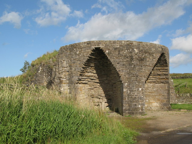
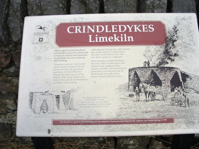
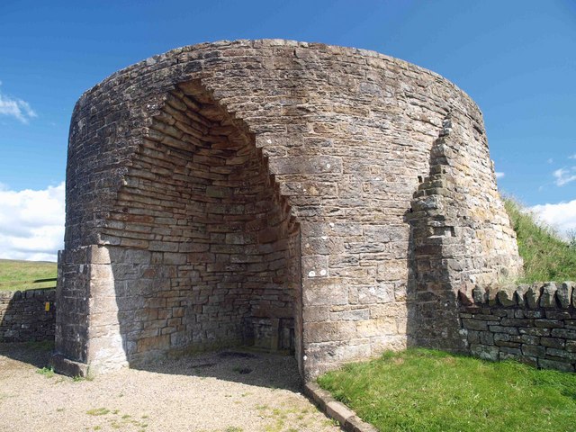
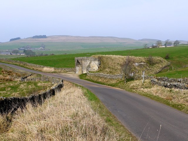
Crinkledikes Lime Kiln
from Geograph (geograph)
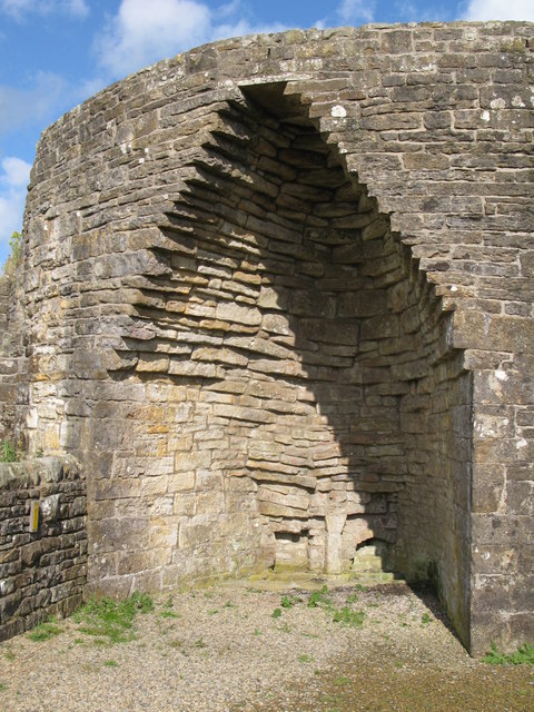
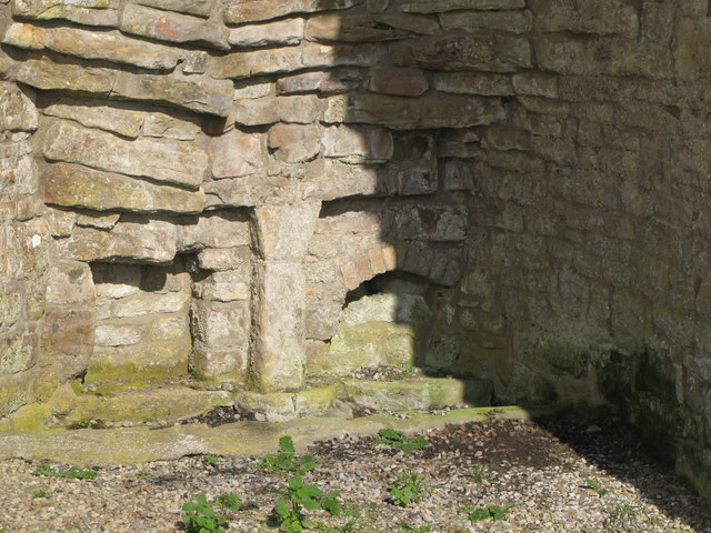
Draw holes in the arch of the Crindledykes lime kiln
Pinned by Simon Cotterill

from https://historicengland.org.u…
LIMEKILN ON EAST SIDE OF ROAD 200 METRES SOUTH WEST OF WEST CRINKLEDIKES FARMHOUSE - List Entry
- "Limekiln, early C19. Squared rubble with stone dressings. Large sub-circular kiln has 3 lofty drawing arches with corbelled heads, each enclosing 2 eyes. Ramp at rear...."
Added by
Simon Cotterill

from Geograph (geograph)
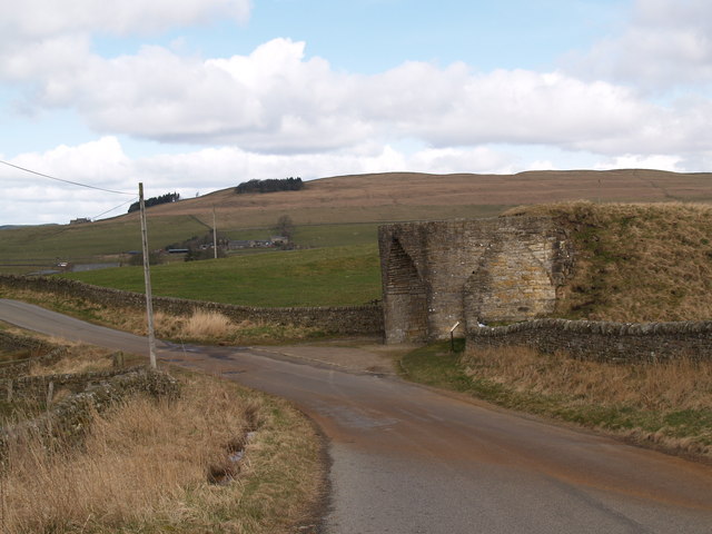
Draw holes in the arch of the Crindledykes lime kiln
Pinned by Simon Cotterill
from https://historicengland.org.u…
LIMEKILN ON EAST SIDE OF ROAD 200 METRES SOUTH WEST OF WEST CRINKLEDIKES FARMHOUSE - List Entry
- "Limekiln, early C19. Squared rubble with stone dressings. Large sub-circular kiln has 3 lofty drawing arches with corbelled heads, each enclosing 2 eyes. Ramp at rear...."
Added by
Simon Cotterill