Wall Mile 20


-
Description
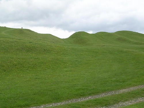
Vallum on Down Hill, with (from left to right) National Trail sign on north mound (how did they get away with that on the skyline?!), north berm, ditch, marginal mound, south berm, then south mound. An old track crosses the line of the Vallum in the foreground. Taken from the old quarry site, looking E. Handbook p.177. -
Owner
The Armatura Press -
Source
Flickr (Flickr) -
License
What does this mean? CC BY-SA 2.0
-
Further information
Link: https://www.flickr.com/photos/83154955@N00/177792710/
Resource type: Image
Added by: Simon Cotterill
Last modified: 4 months ago
Viewed: 70 times
Picture Taken: 2006-05-01T00:00:00 -
Co-Curate tags

