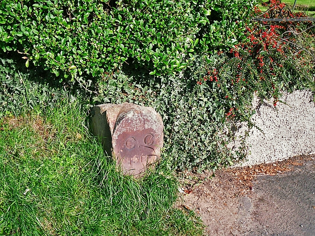
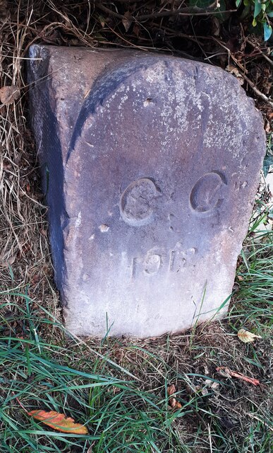
Carlisle city boundary stone, London Road

-
Description
"Red sandstone marker located between Nos 417 and 419 London Road. Inscribed : CC 1912. In that year the municipal borough and civil parish of Carlisle was extended, taking in the townships of Harraby, Upperby, and Botcherby together with parts of Belle Vue, Cummersdale and Stanwix (Kelly's directory of Cumberland and Westmorland, 1914)." Photo by Rose and Trev Clough, 2016. -
Owner
Rose and Trev Clough -
Source
Geograph (Geograph) -
License
What does this mean? Creative Commons License
-
Further information
Link: http://www.geograph.org.uk/photo/5222645
Resource type: Image
Added by: Simon Cotterill
Last modified: 1 year, 2 months ago
Viewed: 203 times
Picture Taken: 2016-10-03 -
Co-Curate tags


 effigy/tomb lid in st James church, castle eden")


