Jackson's Mill, Easington

-
Description
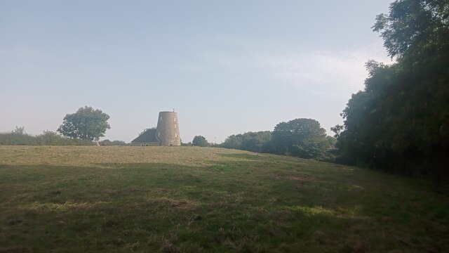
"Current online large-scale maps refer to this eye-catching building as simply 'The Mill'. Historic England - who made it a Grade II listed building in the 1960s - refer to it by its older name though. It appears on Ordnance Survey's first map of here, surveyed in the 1850s; they also refer to the round tower as Jackson's Mill and state that it was used for grinding corn. The small attached more conventional part of the property was added in 1980 and Historic England make clear in their short write-up that this newer part is of no architectural interest whatsoever. Both the old and new parts are lived in today as part of the same property but it isn't clear whether the old windmill had been used as a home - when it was working or afterwards - before the 1980 revamp. A neglected footpath leads from the camera location to a gate to the left of the house and then continues to the main road along its driveway." Photo by Ian Dodds, 2023. -
Owner
Ian Dodds -
Source
Geograph (Geograph) -
License
What does this mean? Creative Commons License
-
Further information
Link: http://www.geograph.org.uk/photo/7627290
Resource type: Image
Added by: Pat Thomson
Last modified: 1 year, 1 month ago
Viewed: 247 times
Picture Taken: 2023-09-08 -
Co-Curate tags


