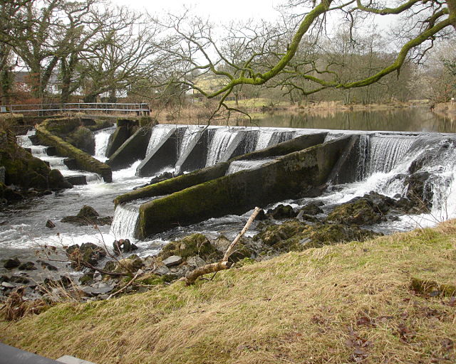
Bowston weir


-
Description
"A complex weir and a bit of a nightmare for canoeists, undoubtedly unrunnable at this low level. The guidebook suggests a possible route river left down the chute seen on the right of the photo. The landing looks rocky, but that is better than the concrete ledges of the main part of the weir, and may generate enough aerated water for a vaguely soft landing when the flow is sufficient. Fortunately, the river left bank (from where the photograph was taken) is a public footpath, so portage is straightforward." Photo by Andy Waddington, 2010. -
Owner
Andy Waddington -
Source
Geograph (Geograph) -
License
What does this mean? Creative Commons License
-
Further information
Link: http://www.geograph.org.uk/photo/1716013
Resource type: Image
Added by: Simon Cotterill
Last modified: 2 years, 4 months ago
Viewed: 326 times
Picture Taken: 2010-02-16 -
Co-Curate tags


