Triangulation Pillar, Cardurnock


-
Description
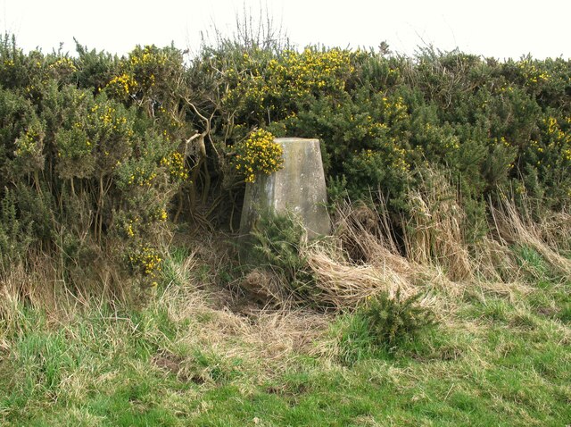
"The concrete Ordnance Survey triangulation pillar beside a gorse hedge at Cardurnock. The pillar was constructed in 1952. The flush bracket benchmark number S6939 on the west southwest face of the pillar marks a height of 18.9558m above mean sea level (Ordnance Datum Newlyn) last levelled for height in 1971 (detail photograph [[7340151]])." Photo by Adrian Taylor, 2009. -
Owner
Adrian Taylor -
Source
Geograph (Geograph) -
License
What does this mean? Creative Commons License
-
Further information
Link: http://www.geograph.org.uk/photo/7340098
Resource type: Image
Added by: Simon Cotterill
Last modified: 2 years, 11 months ago
Viewed: 432 times
Picture Taken: 2009-03-15 -
Co-Curate tags


