Flakebridge and the Howgill Fells


-
Description
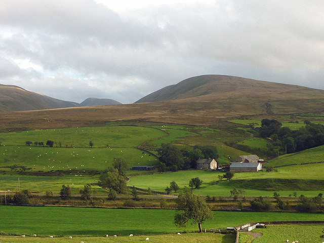
"A zoom shot from the north across the infant River Lune. The A685 can be seen running in a straight line through the foreground pastures. Above the farm is the rounded ridge of West Fell with the peaked summit of Yarlside to its left rising above Bowderdale." Photo by Karl and Ali, 2011. -
Owner
Karl and Ali -
Source
Geograph (Geograph) -
License
What does this mean? Creative Commons License
-
Further information
Link: http://www.geograph.org.uk/photo/2593658
Resource type: Image
Added by: Simon Cotterill
Last modified: 3 years ago
Viewed: 470 times
Picture Taken: 2011-09-09 -
Co-Curate tags


