MILESTONE AT NATIONAL GRID REFERENCE NY 49170 59980 -Ruleholme - List Entry


-
Description
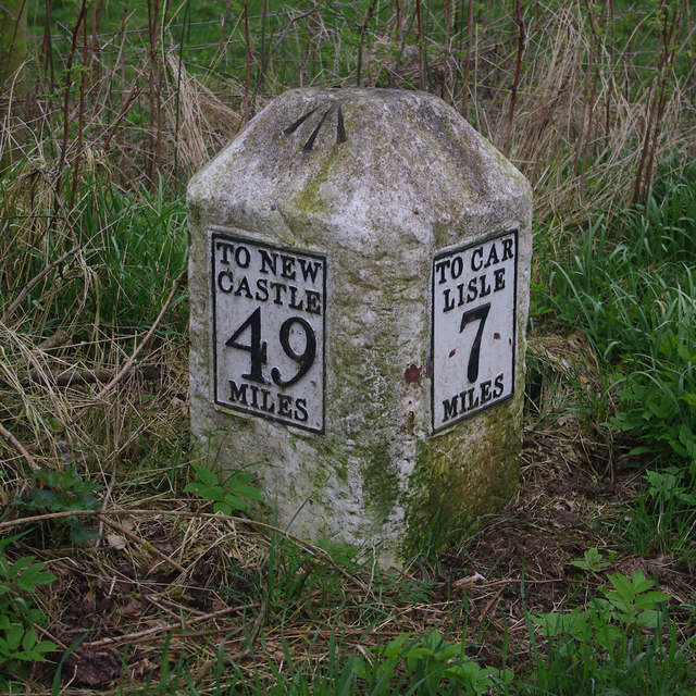
"Miilestone. Probably 1758, for the Carlisle-Newcastle Military Road. Sandstone, cast-iron plates. Chamfered stone to give 2 faces in direction of traffic, one face with cast plate in 4 lines CARLISLE 7 MILES, other face TO NEWCASTLE 49 MILES in 4 lines. Whitewashed over and lettering picked-out in black. In 1811 the road became the Carlisle-Temon Turnpike. Each milestone is clearly drawn on Hodgkinson and Donalds map of Cumberland and Westmorland, surveyed 1770...." -
Owner
Historic England -
Source
Local (Co-Curate) -
License
What does this mean? Unknown license check permission to reuse
-
Further information
Link: https://historicengland.org.uk/listing/the-list/list-entry/1087624
Resource type: Text/Website
Added by: Simon Cotterill
Last modified: 2 years, 11 months ago
Viewed: 435 times
Picture Taken: Unknown -
Co-Curate tags


