Ruleholme Bridge

-
Description
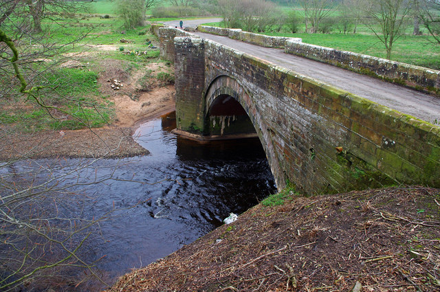
"The upstream side of the bridge. This bridge carried the road between Carlisle and Brampton (northern route - B6264) over the River Irthing. In the 1970s, this route was upgraded (becoming the A689) and a new bridge was built to the SE. The bridge has been closed to traffic for a few years, presumably due to flood damage. It appears that in preparation for repairs, trees have been cut down close to the bridge. Grade II Listed - see https://www.historicengland.org.uk/listing/the-list/list-entry/1312004 (Compare with 2006 photo [[128104]].)" Photo by Ian Taylor, 2018. -
Owner
Ian Taylor -
Source
Geograph (Geograph) -
License
What does this mean? Creative Commons License
-
Further information
Link: http://www.geograph.org.uk/photo/5749935
Resource type: Image
Added by: Simon Cotterill
Last modified: 3 years, 1 month ago
Viewed: 375 times
Picture Taken: 2018-04-20 -
Co-Curate tags

")


