Pelton Grange farm


-
Description
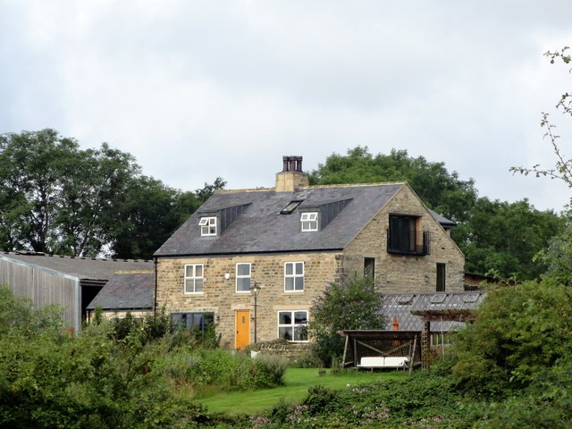
"This farm stands north of Pelton Lane, at the east side of Grange Villa. The farm gave its name to the ex mining village of Grange Villa, which was founded in the late C19 to house miners working at Handen Hold Colliery. The farm is shown on the 1861 First Series Ordnance Survey map. The layout on the map suggests an early Victorian planned courtyard farmstead, but I don't know its exact history. The farmhouse shown here seems to show quite a lot of modernisation." Photo by Robert Graham, 2019. -
Owner
Robert Graham -
Source
Geograph (Geograph) -
License
What does this mean? Creative Commons License
-
Further information
Link: http://www.geograph.org.uk/photo/6244532
Resource type: Image
Added by: Simon Cotterill
Last modified: 3 years, 4 months ago
Viewed: 987 times
Picture Taken: 2019-08-12 -
Co-Curate tags


