East side of Standing Stone at The Poind & His Man


-
Description
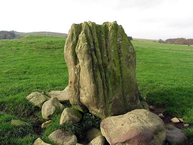
"See description here [[4226462]] The Roman road, known as The Devil's Causeway, passes diagonally through the field just behind the stone but is little visible. The raised part of the field has the place-name, Humlie Dod." Photo by Andrew Curtis, 2014. -
Owner
Andrew Curtis -
Source
Geograph (Geograph) -
License
What does this mean? Creative Commons License
-
Further information
Link: http://www.geograph.org.uk/photo/4226482
Resource type: Image
Added by: Simon Cotterill
Last modified: 3 years, 4 months ago
Viewed: 577 times
Picture Taken: 2014-10-31 -
Co-Curate tags


