Chester-le-Street: flood alleviation

-
Description
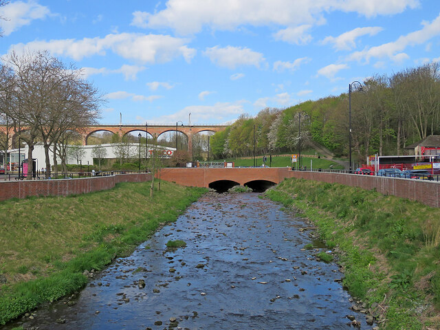
"Chester (or Cong) Burn was culverted under the Market Place in 1962. Following floods in 2012 this was identified as the main cause and a £6.2m scheme funded by Durham County Council, the Environment Agency and the European Union Regional Development Fund which uncovered the burn should reduce the risk of flooding from exceptional storms. A nearby information board explains that the flood walls north and south of the re-exposed burn increase its capacity, allowing it to hold more water to reduce the risk of flooding. The area has been landscaped to "create a more welcoming, park-like feel". The railway viaduct is in the distance to the left of centre." Photo by John Sutton, 2022. -
Owner
John Sutton -
Source
Geograph (Geograph) -
License
What does this mean? Creative Commons License
-
Further information
Link: http://www.geograph.org.uk/photo/7156099
Resource type: Image
Added by: Simon Cotterill
Last modified: 3 years, 7 months ago
Viewed: 523 times
Picture Taken: 2022-04-23 -
Co-Curate tags


