Overgrown Byway at Brunton Airfield


-
Description
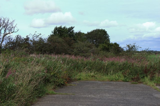
"A public byway is shown on current Ordnance Survey maps as carrying on in a straight line to the end of the concrete track and on through the overgrown bushes and trees ahead. Thankfully there are gates into the fields either side of the overgrown fenced off track." Photo by Graham Robson, 2019. -
Owner
Graham Robson -
Source
Geograph (Geograph) -
License
What does this mean? Creative Commons License
-
Further information
Link: http://www.geograph.org.uk/photo/6256994
Resource type: Image
Added by: Simon Cotterill
Last modified: 4 years, 11 months ago
Viewed: 662 times
Picture Taken: 2019-08-31 -
Co-Curate tags


