Embankment of dismantled Waverley Railway


-
Description
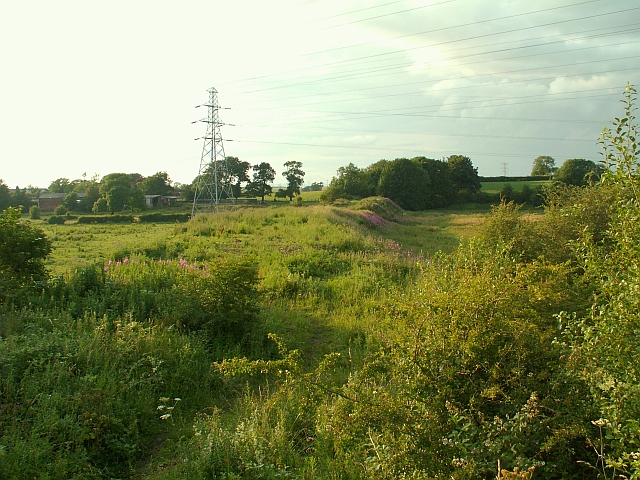
"Farm buildings at Stainton can be seen on the left. The view could change soon, as there are plans to restore the natural flood plain of the River Eden in this area. The railway embankment currently acts as a dam, and will be lowered. This will hopefully alleviate flooding to the Willowholme district of Carlisle, where an electricity substation supplying thousands of homes was knocked out by floods in January 2005." Photo by Rose and Trev Clough, 2009. -
Owner
Rose and Trev Clough -
Source
Geograph (Geograph) -
License
What does this mean? Creative Commons License
-
Further information
Link: http://www.geograph.org.uk/photo/1411846
Resource type: Image
Added by: Simon Cotterill
Last modified: 6 years, 8 months ago
Viewed: 601 times
Picture Taken: 2009-07-05 -
Co-Curate tags


