St Michael and All Angels', Ainstable

-
Description
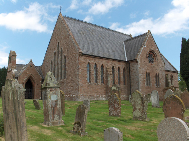
"The church doesn't have the tower which the Ordnance Survey mark on their 1:25000 map. There may have formerly been a tower as I found references to one on the internet. The church is on the boundary of grid squares and is here viewed from the southwest." Photo by Andrew Smith, 2006. -
Owner
Andrew Smith -
Source
Geograph (Geograph) -
License
What does this mean? Creative Commons License
-
Further information
Link: http://www.geograph.org.uk/photo/212965
Resource type: Image
Added by: Simon Cotterill
Last modified: 6 years, 11 months ago
Viewed: 638 times
Picture Taken: 2006-07-27 -
Co-Curate tags


